Hunting Transition Zones: How to Find More Elk and Deer in the West
ElkWhitetailUnit Strategy
3 min read·Jun 9, 2026·TAGZ
Hunting Transition Zones: How to Find More Elk and Deer in the West

Transition zones are that overlooked middle ground where game moves between bedding, feeding, and security cover. If you want to see more elk or deer, especially when pressure is high, you need to stop focusing only on obvious bedding or feeding areas and start hunting the travel routes and in-between habitat that animals actually use most.

Why Transition Zones Matter More Than Hotspots

Every fall, I see guys glassing up obvious meadows or sitting on well-known feeding benches. Sometimes it pays off, but more often, those spots are hammered by daylight. Mature elk and deer use them in the dark, then slip out through transition country at first light. If you’re not set up where they move, you’re watching empty ground.

Transition zones are the brushy drainages, benches, finger ridges, or timber strips connecting bedding and feeding. They’re not flashy, but they see the most animal movement during legal shooting light. These travel corridors let game avoid pressure and move with the wind in their favor. If you want to consistently find animals, especially public land elk or pressured muleys, learning to identify and hunt these zones is key.

Reading Terrain and Pressure the Right Way

In the West, transition zones usually run along contour lines, not straight up and down. Elk and deer will sidehill to conserve energy, using benches, saddles, or old burns as cover. If you look for pinch points — where cover narrows, or terrain forces movement — you’ll find sign: tracks, scat, or rubs. Google Earth can help, but boots-on-the-ground scouting is better. Look for:

  • Game trails skirting steep slopes
  • Saddles between timber patches
  • Brushy draws leading away from meadows
  • Benches just below ridge lines

Pressure matters. If you’re hunting OTC elk or heavily-trafficked units, expect animals to shift their routes downwind of roads and trails. They’ll often use transition zones in low light, or midday to move between cover. Set up just off the obvious, and you’ll see more game slipping through than the guys crowding the meadows.

Scouting and Hunt Strategy for Real Success

My best days have come from parking further away and hiking into those in-between spaces. I’ll glass feeding areas at dawn, then slip back into the timber to catch animals moving out. Midday, I’ll still-hunt through transition corridors, looking for fresh sign and bedding pockets. It’s not glamorous, but it’s effective.

Expect to cover ground and move slow. Elk especially will use the same transition routes year after year unless pressured hard. Mark fresh sign and try to intersect travel routes based on wind and thermals. Don’t expect to see herds out in the open — most encounters are close, quick, and require patience.

TAGZ makes this easier by letting you study topo, compare draw odds, and even mark possible transition corridors before you burn boot leather. It won’t replace scouting, but it can cut your learning curve in a new unit.

FAQs: Transition Zone Hunting

What’s the best time of day to hunt transition zones?

First and last light are best, but don’t ignore mid-morning or midday movement, especially during rifle seasons with heavy pressure.

Should I sit or still-hunt these areas?

Both work. If you find a well-used trail or pinch point, set up and watch. Otherwise, move slow and glass ahead — patience pays.

How do I find transition zones on the map?

Look for cover strips between open and dark timber, benches along slopes, or drainages connecting two habitats. Use satellite and topo layers together.
Draw odds
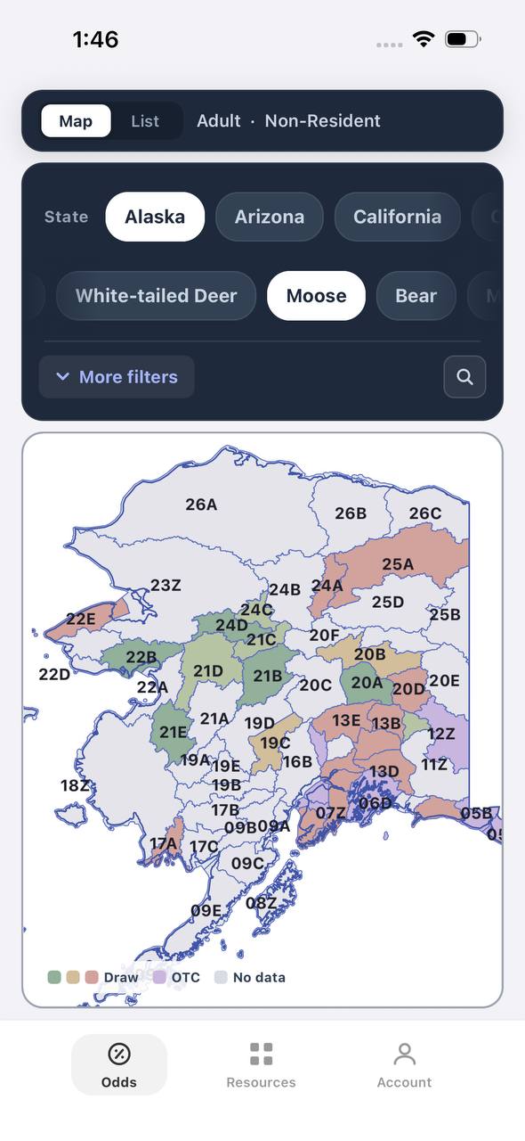
Alaska moose draw odds by unit, colored by draw, OTC, or no data
AdultNonresident

Alaska · Moose

Draw, OTC, and no-data units across the whole state.

Adult, Nonresident, Moose, no additional filters. Every unit is colored by its best matching draw odds; if nothing draws, it shows OTC; if neither, no data.

  • Alaska mixes draw and OTC moose hunts within the same region.
  • Green units are worth an application; purple units are OTC.
  • Filters stay applied when a unit is opened for hunt detail.
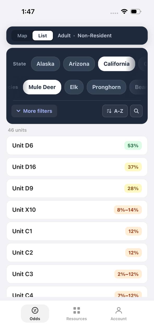
Draw odds
California mule deer draw odds ranked by unit in a list
AdultNonresident

California · Mule deer

Nonresident odds ranked unit by unit.

Adult, Nonresident, Mule deer, no weapon or season chip, so every matching hunt in a zone is combined into one badge and sorted by best projected odds.

  • D6 leads the list; a range like 8%–14% means more than one hunt code exists in that zone.
  • The list and the map read the same filtered hunt set.
  • 46 units are shown for this species and state alone.

Free to join

Download mobile app

  • Detailed draw odds
  • Point tracking
  • Deadline reminders
  • 18 states covered
Download on the App StoreGet it on Google Play
Unit detail
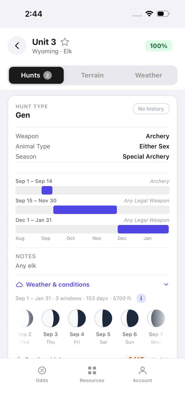
Wyoming elk unit detail, hunts tab, showing hunt windows on a timeline

Wyoming · Elk, Unit 3

Every hunt window inside one unit, laid out on a timeline.

Unit 3 has two hunt codes for elk. Each one shows its weapon, animal type, and season as a bar on a shared Aug–Jan timeline, plus a day-by-day moon phase strip.

  • Archery, then a long Any Legal Weapon window, then a late season — three opportunities in one unit.
  • The 100% badge at top means no real draw competition for the selected filters right now.
  • Weather & conditions expands below the hunt list without leaving the unit.
Terrain data
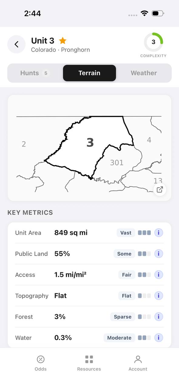
Colorado pronghorn unit detail, terrain tab, showing unit outline and key metrics

Colorado · Pronghorn, Unit 3

Unit boundaries and a complexity score at a glance.

The Terrain tab draws the unit outline against its neighbors and scores it for complexity, then breaks out area, public land, access, topography, forest, and water.

  • 849 sq mi, 55% public land, and flat topography make this a fairly approachable unit.
  • Each metric carries a short rating word — Vast, Some, Fair, Flat, Sparse, Moderate — with a tooltip.
  • The outline map shows adjacent units 2, 4, 13, and 301 for context.
State profiles
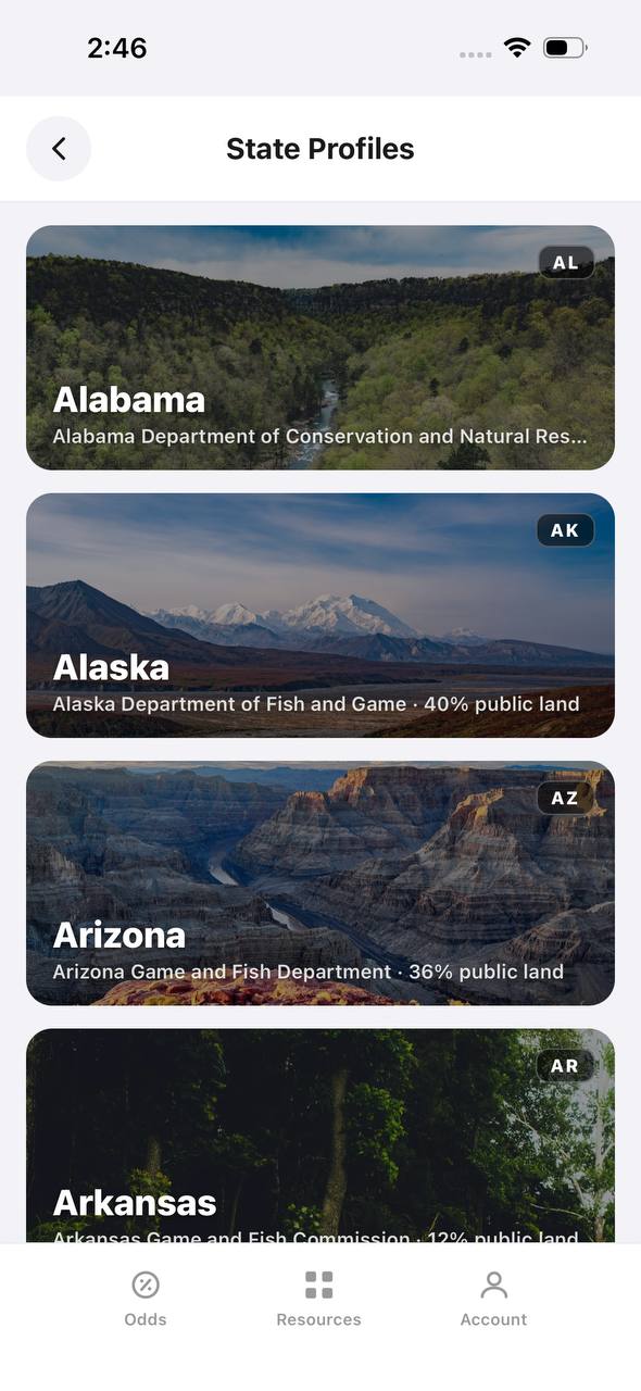
State Profiles screen listing states with wildlife agency and public land percentage

State Profiles

Each state's wildlife agency and public land share, at a glance.

State Profiles lists every covered state as a photo card naming its wildlife agency and, where available, its public land percentage.

  • Public land percentage shows right in the list, before opening the state.
  • Each card names the exact agency the regulations come from.
  • States without a public land figure yet, like Alabama here, are still listed.
Points wallet
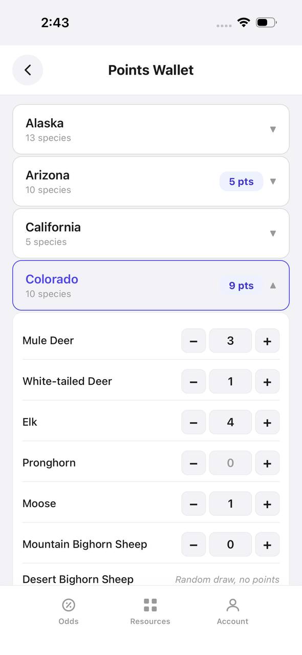
Points Wallet screen with Colorado expanded, showing a point stepper per species

Points Wallet · Colorado

Every state and species point balance in one wallet.

Points Wallet lists each state with a species count; expanding a state, like Colorado here, shows a stepper for every species so a balance can be entered or adjusted directly.

  • Colorado alone tracks points across 10 species independently.
  • Species with no points, like Pronghorn here, still show a zero to stay visible.
  • Desert Bighorn Sheep is flagged as a random draw with no points system.

Free to join

Download mobile app

  • Detailed draw odds
  • Point tracking
  • Deadline reminders
  • 18 states covered
Download on the App StoreGet it on Google Play
Draw odds
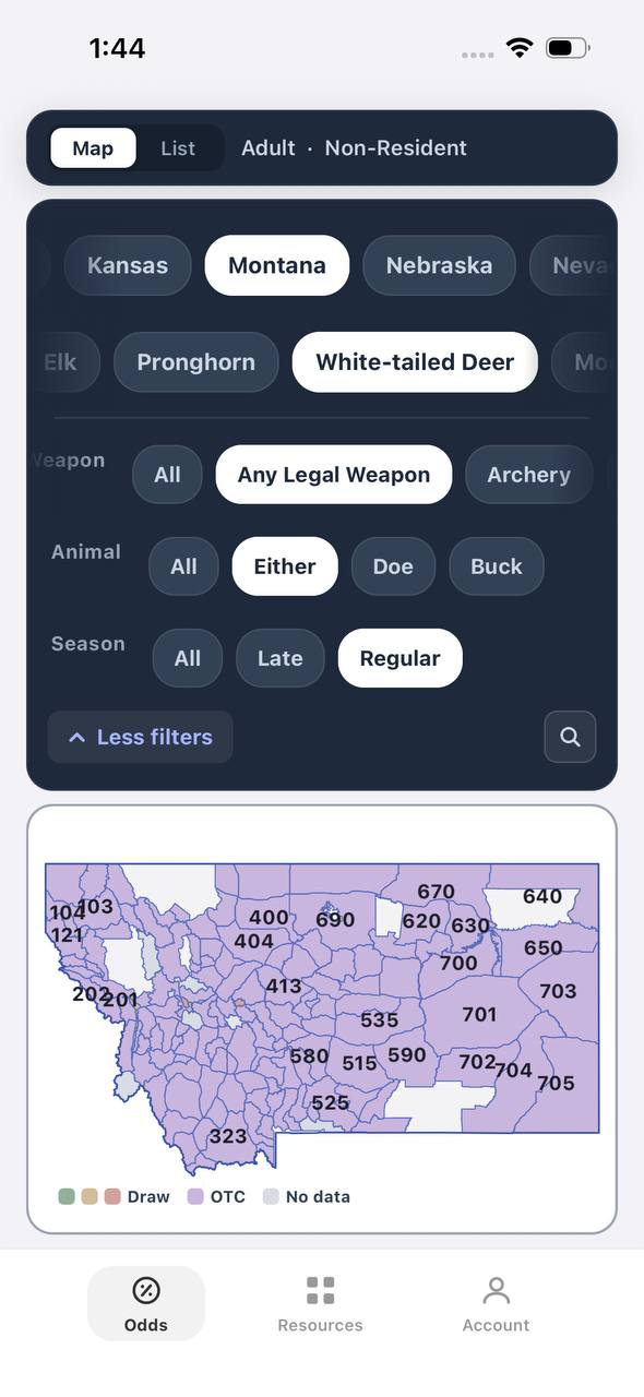
Montana white-tailed deer draw odds filtered to any legal weapon, either sex, regular season
AdultNonresidentAny Legal WeaponEitherRegular

Montana · White-tailed deer

Nearly the whole state is OTC for this filter combination.

Adult, Nonresident, White-tailed deer, filtered to Any Legal Weapon, Either, Regular. Under this combination almost every unit turns purple — over the counter.

  • Switching weapon, sex, or season changes the picture completely.
  • Purple means the tag can be bought directly, no draw.
  • This is the tag-and-go read of Montana whitetail, not the point-based one.
Terrain data
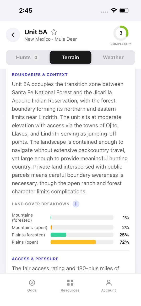
New Mexico mule deer unit 5A terrain tab with boundary description and land cover breakdown

New Mexico · Mule deer, Unit 5A

A written boundary description, not just a shape.

Unit 5A's terrain tab opens with a plain-language paragraph about surrounding land, access towns, and ownership mix, then a land cover breakdown by percentage.

  • 72% open plains and 25% forested plains describe the terrain at a glance.
  • The boundary text calls out the exact reservation and forest lines that define the unit.
  • Access & pressure continues below the fold with mileage detail.
Draw odds
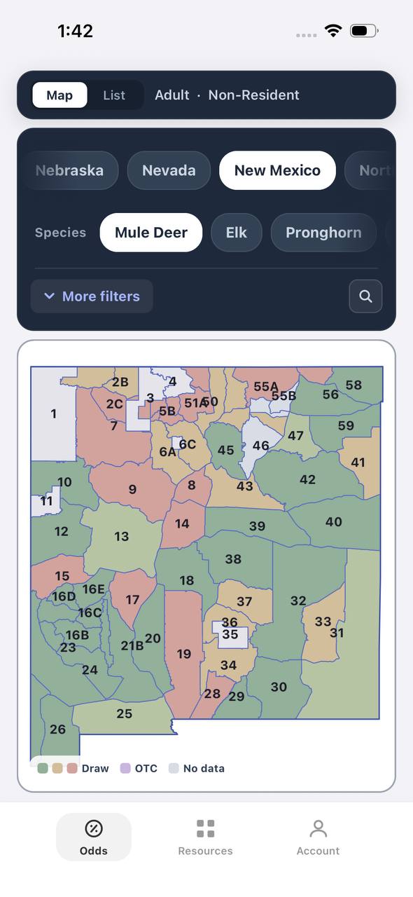
New Mexico mule deer draw odds by unit
AdultNonresident

New Mexico · Mule deer

Mule deer draw odds for every unit in the state.

Adult, Nonresident, Mule deer, all weapons and seasons. Each unit is colored by the same odds calculation used in the dashboard.

  • Green and tan together separate units worth applying to from units that are not.
  • Numbered units follow New Mexico's own game management unit boundaries.
  • Opening a unit shows the exact hunt behind the color.
Favorites
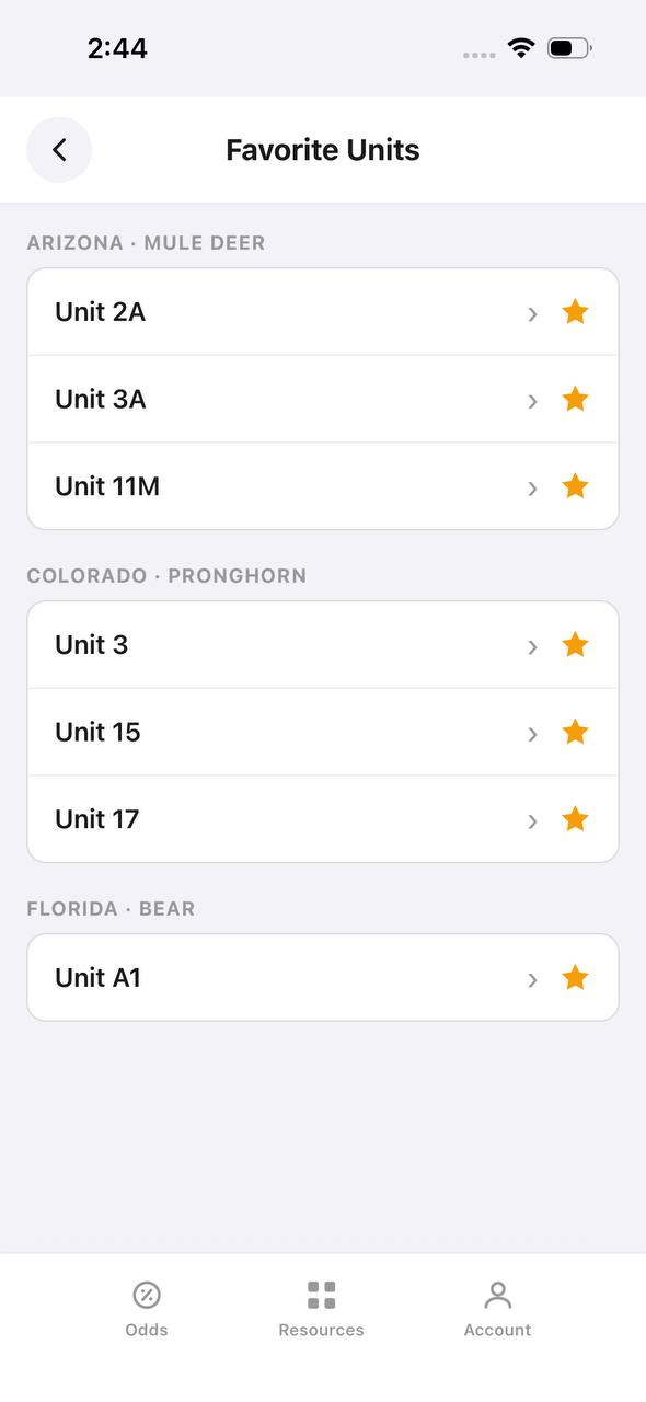
Favorite Units screen grouped by state and species

Favorite Units

Starred units from any state, grouped by species.

Favorite Units collects every starred unit across states and species into one list, grouped by state and species pair, so a saved unit is one tap away.

  • Arizona mule deer and Colorado pronghorn favorites sit side by side here.
  • Each row opens straight into that unit's detail view.
  • Unstarring from this screen removes it from the group instantly.
Deadlines
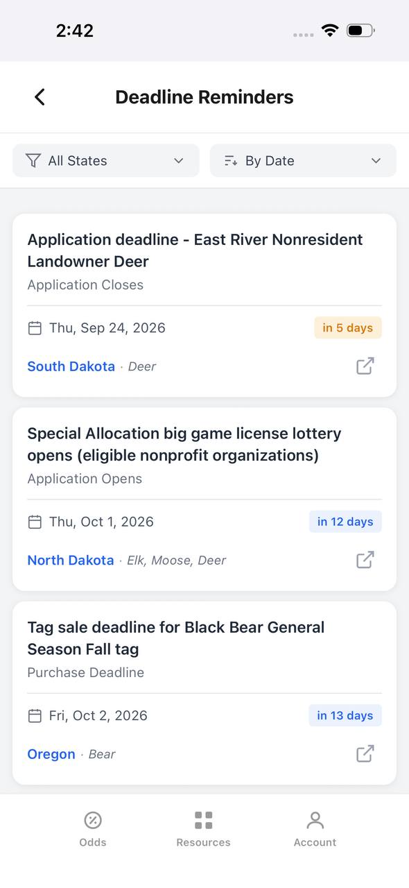
Deadline Reminders screen listing application and purchase deadlines by date

Deadline Reminders

Every application and purchase deadline, sorted by date.

Deadline Reminders filters by state and sorts by date, showing the deadline type, a countdown, and the state and species it applies to, with a link out to the source.

  • Countdown badges shift as a deadline gets close — "in 5 days" here, for example.
  • Application opens and closes are tracked as separate reminder types.
  • Each card links out to confirm the rule at the source.
Interactive map
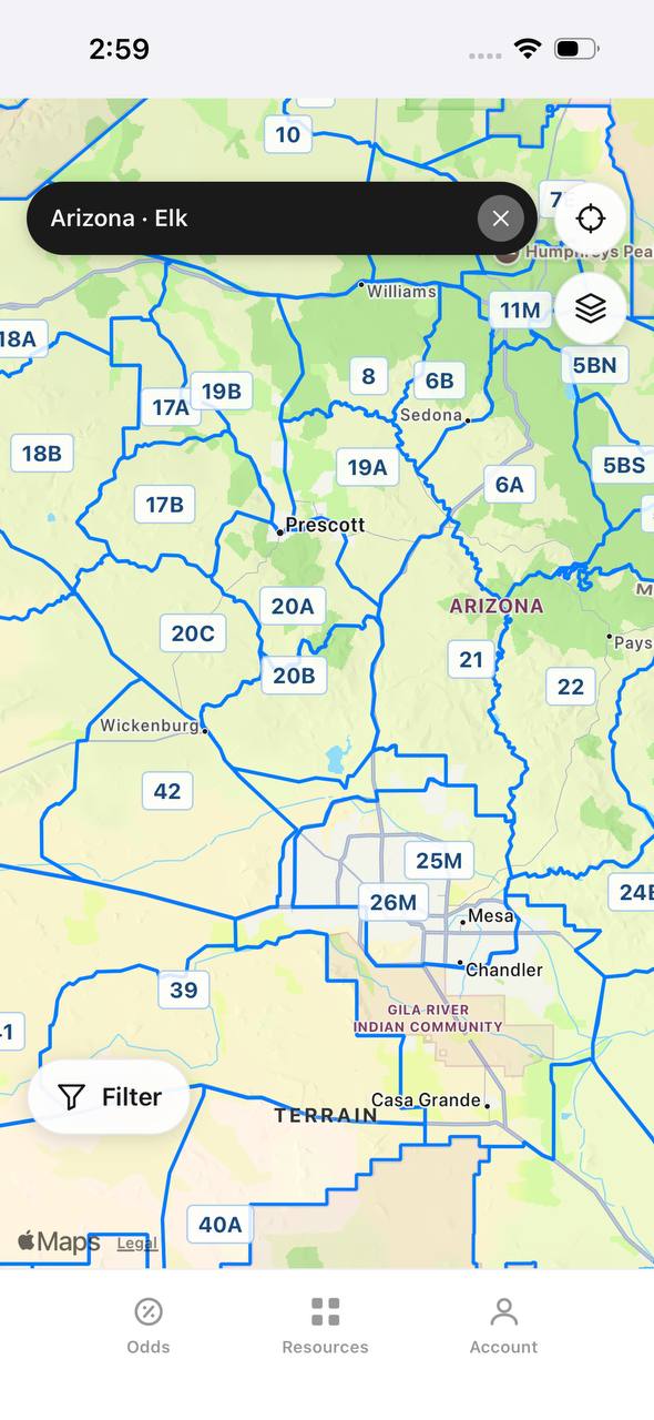
Arizona elk unit boundaries overlaid on an interactive street map

Arizona · Elk

Unit boundaries laid directly over a real map.

This view overlays Arizona elk unit boundaries and labels on top of a street map, with a search bar pinned to state and species and a layer toggle in the corner.

  • Real towns like Prescott and Sedona sit inside their unit boundaries for context.
  • A location button and layer switch float over the map, clear of the unit labels.
  • A Filter button at the bottom opens the same filters used elsewhere in the app.

Free to join

Download mobile app

  • Detailed draw odds
  • Point tracking
  • Deadline reminders
  • 18 states covered
Download on the App StoreGet it on Google Play
Insights
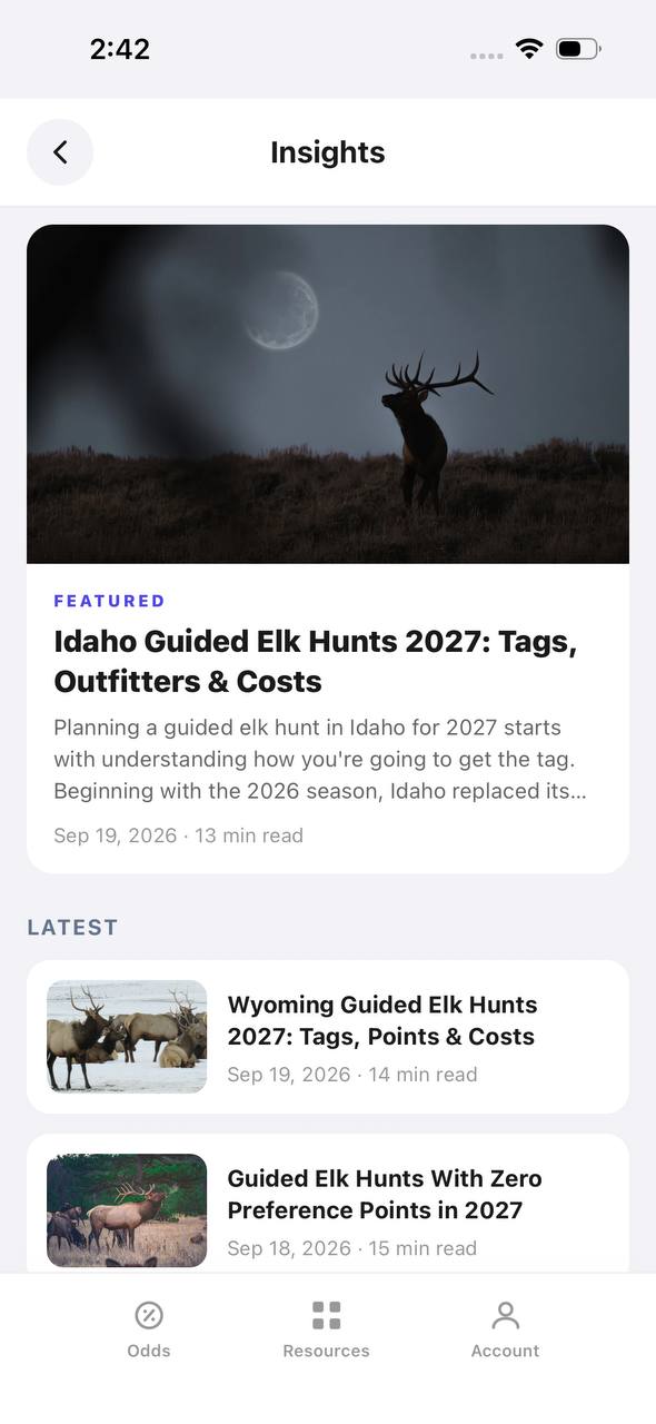
Insights screen with a featured article and a latest articles list

Insights

Hunting articles, built into the app itself.

Insights opens to a featured article with a hero image, then a Latest list of recent posts, each with a thumbnail, read time, and publish date.

  • The featured slot rotates to the newest deep-dive article.
  • Read time and publish date show on every card, not just the featured one.
  • This mirrors the blog content already published on the marketing site.
Download on the App StoreGet it on Google Play

More Practical Tips for Western Hunters

  • Don’t be afraid to hunt the "boring" looking stuff between obvious spots
  • Always check the wind — transition routes are where animals test the air
  • Use TAGZ to compare unit terrain, draw odds, and pressure before you commit

If you want to dig deeper on reading terrain, check out our guide to finding overlooked elk country or learn more about using topo maps for scouting.