How Outfitters Scout New Units: Proven Methods for Finding Elk, Deer, and Antelope
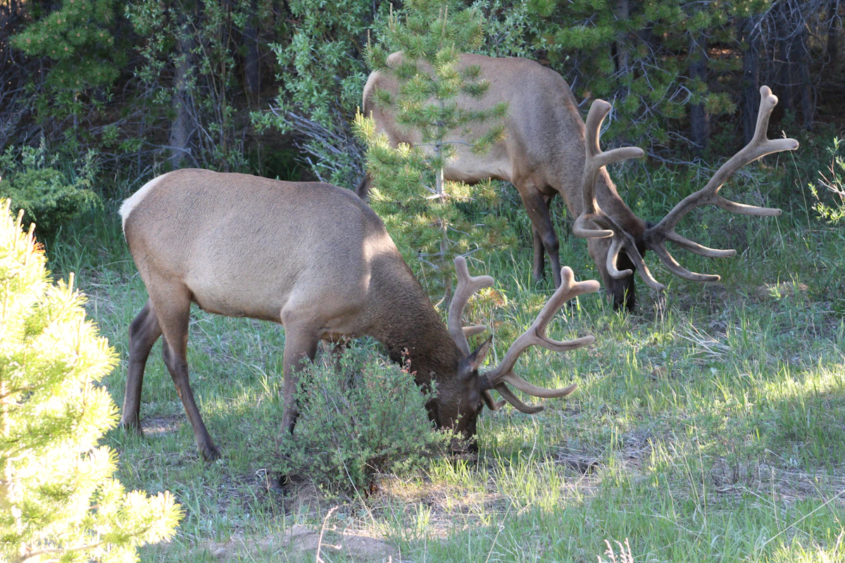
When an outfitter decides to expand into a new hunting unit, they are not gambling on gut feelings or hoping for the best. Professional guides follow a systematic scouting process that combines technology, field time, and local intelligence to identify productive hunting areas before ever bringing a paying client into unfamiliar territory. Understanding this process can help DIY hunters apply the same proven methods to their own hunt planning.
Start with Digital Mapping and Historical Data
Every successful scouting mission begins at a computer, not in the field. Outfitters start by layering multiple data sources to identify areas worth investigating in person.
The foundation is understanding draw statistics and historical harvest data. State wildlife agencies publish harvest success rates, total tags issued, and sometimes even hunter density by unit. This tells an outfitter whether a unit produces consistent opportunities or if success hinges on drawing a rare tag. Tools like TAGZ compile this information across multiple states, allowing outfitters to compare units side by side using terrain maps, unit boundaries, and historical draw data without manually searching through dozens of state agency websites.
Next comes terrain analysis. Outfitters overlay topographic maps with satellite imagery to identify transition zones between feeding and bedding areas. They look for north-facing slopes that hold snow longer and provide thermal cover for elk, creek drainages that funnel deer movement, and ridge systems that offer glassing vantage points. Public land boundaries matter just as much as terrain. An outfitter needs to know where Forest Service land ends and private ranches begin, and whether access roads penetrate deep enough to reach huntable country without requiring horses or a wilderness backpack camp.
Water sources become critical in arid western units. An outfitter studying a new Wyoming antelope unit will mark every stock tank, windmill, and natural spring on the map. In September, water is life, and knowing where animals must drink can turn a 40,000-acre unit into a manageable hunt area.
Local Intel: Talking to Biologists, Ranchers, and Other Outfitters
No amount of digital scouting replaces human intelligence. Before spending days in the field, experienced outfitters make phone calls and schedule meetings with people who know the ground.
State wildlife biologists are the first call. Most biologists are willing to share general information about wildlife distribution, migration timing, and access challenges. An outfitter might ask which drainages hold the most elk in late September, whether deer populations are rebounding after a harsh winter, or if a recent wildfire pushed animals into adjacent units. Biologists will not hand over GPS waypoints of trophy animals, but they will steer an outfitter toward productive areas and away from units with declining populations or access problems.
Ranchers and local landowners provide ground-truth information that no agency report can match. If an outfitter plans to hunt public land adjacent to private ranches, introducing themselves to landowners can reveal crucial details about animal movement patterns. A rancher might mention that elk pour onto their hayfields every evening from the national forest above, or that deer migrate through a specific pass in mid-October. This conversation might also open doors to permission for access across private land to reach landlocked public parcels, a game-changer in many western units.
Other outfitters operating in nearby units can offer insights, though this requires diplomacy. Most guides respect professional courtesy and will share general information about migration routes, snow timing, and which trailheads get overcrowded during rifle season. This network becomes especially valuable when scouting units in new states where local knowledge makes the difference between success and failure.
Boots on the Ground: Pre-Season Reconnaissance Trips
Digital maps and phone calls narrow the focus, but nothing replaces time in the field. Outfitters schedule pre-season scouting trips weeks or months before the hunt to validate their desktop research.
The first trip typically happens in late spring or early summer. The goal is not to pattern individual animals but to verify access routes, evaluate camp locations, and confirm that terrain matches what the maps suggested. An outfitter will drive every forest road, hike into proposed spike camp locations, and identify glassing points that overlook multiple basins. They are looking for logistical answers: Can a truck and horse trailer navigate this two-track? Is there enough flat ground and water for a wall tent camp? Which ridges offer sunrise and sunset glassing opportunities?
This early trip also reveals human pressure. Outfitters note how many other camps are established in popular areas, whether ATVs have created unauthorized trails, and if certain trailheads are clearly overused. In units with significant pressure, this information shapes decisions about where to focus efforts or whether to invest in a wilderness hunt where horses provide a competitive advantage.
The second critical scouting trip happens closer to the season, ideally within two to four weeks of opening day. Now the focus shifts to current wildlife activity. Outfitters look for fresh sign: rub lines on aspens indicating bull elk are marking territory, scrapes showing rutting deer behavior, and fresh tracks in creek crossings revealing travel patterns. They glass at dawn and dusk to locate animals and assess age class and antler quality. Finding a herd of 50 elk in a remote basin is valuable intelligence, but finding that herd with a mature 6x6 bull confirms the unit holds the caliber of animal worth pursuing.
During this late-summer reconnaissance, outfitters also test their communication and safety plans. They identify cell phone dead zones, note the nearest hospital or ranger station, and mark GPS coordinates for emergency helicopter landings. These details matter when operating in remote country with paying clients.
Using Technology: Trail Cameras, Apps, and Mapping Software
Modern outfitters supplement traditional scouting with technology that extends their reach and provides continuous monitoring.
Trail cameras placed at water sources, game trails, and migration corridors provide 24-hour surveillance when the outfitter cannot be in the field. A single strategically placed camera can reveal which animals are using an area, what time they move, and whether they are following a predictable pattern. Outfitters typically place cameras in mid-summer and check them multiple times before the season. Cellular trail cameras that send photos directly to a smartphone allow real-time monitoring without disturbing the area.
Mapping apps like onX Hunt, Gaia GPS, and BaseCamp allow outfitters to mark waypoints during scouting trips and share locations with assistant guides. They can drop pins on glassing knobs, water sources, and areas with fresh sign, building a digital database of hunt-critical information. These apps also provide real-time GPS tracking, preventing guides and clients from accidentally crossing onto private land or wandering outside unit boundaries.
Weather forecasting apps and satellite imagery help outfitters anticipate animal movement. A snowstorm forecast can trigger an early migration of elk from high country to lower elevation timber. Satellite images showing green-up patterns reveal where deer and elk are likely feeding as they follow the leading edge of new growth up the mountain. Outfitters monitor these patterns during their scouting trips to predict where animals will be during the actual hunt.
TAGZ helps outfitters track preference points and bonus points across multiple states so they never miss a draw deadline, while providing tools to compare units side by side using terrain maps and historical draw data. Whether chasing OTC tags or planning a trophy limited-entry hunt, TAGZ gives outfitters and DIY hunters the tools to make smarter decisions before ever stepping into the field.
Evaluating Access Points and Camp Locations
An outfitter can identify the perfect hunting area, but without reliable access and a functional camp location, the hunt falls apart. Access planning is a critical component of scouting new units.
Outfitters identify multiple access routes to the same hunting area. If the primary forest road gets snowed in or washed out, they need a backup plan. They also evaluate whether roads are suitable for two-wheel drive trucks, require four-wheel drive, or demand high-clearance vehicles. This determines what kind of equipment the outfitter needs and whether clients can reach camp without requiring a shuttle service.
Camp location depends on the hunt style. For spot-and-stalk rifle hunts, outfitters prefer camps positioned centrally between multiple hunting areas, typically near water and with enough flat ground for tents, a cook station, and horse corrals. For archery elk hunts focused on calling, camps might be placed closer to known bedding areas to allow hunters to reach prime glassing points before first light. In wilderness areas, outfitters identify spike camp locations that require a two-hour horseback ride from the trailhead, providing separation from road hunters.
Permit requirements also shape access decisions. Some national forests require special-use permits for commercial outfitting, and certain wilderness areas limit the number of outfitter camps allowed. Outfitters verify these regulations during the scouting process and secure necessary permits months in advance. Failing to do this homework can result in expensive fines and a ruined hunt.
Timing the Hunt: Migration, Rut, and Weather Windows
Successful outfitters do not just scout for where animals are—they scout for when animals will be there during the season.
Migration timing is critical in many western units. Elk that spend summer in high alpine basins may not drop to huntable elevations until mid-October, well after September archery seasons close. Mule deer bucks summering above timberline follow similar patterns. During their scouting trips, outfitters talk to biologists and ranchers to understand average migration windows, then adjust hunt dates accordingly. They also monitor snowfall patterns from previous years to predict how early or late migration might occur.
Rut timing influences elk and deer behavior and shapes when an outfitter schedules hunts. Elk are most vocal and responsive to calling during the peak rut, typically mid-September in most units. Mule deer rut peaks in mid-November, making that period ideal for glassing bucks cruising for does. Outfitters time their scouting trips to align with these patterns, observing rutting behavior to confirm the unit's activity windows match state averages.
Weather windows can make or break a hunt. Early-season archery hunts in dry units might offer limited opportunities until the first snow pushes elk out of remote basins. Late-season rifle hunts depend on snow depth—too little and animals remain scattered, too much and they migrate entirely out of the unit. Outfitters use their scouting trips to identify weather-dependent patterns and set realistic expectations with clients about timing and conditions.
Adapting Strategy Based on What Scouting Reveals
The final step in scouting a new unit is honest evaluation and strategy adjustment. Not every unit lives up to its reputation, and experienced outfitters know when to pivot.
If scouting reveals lower animal numbers than expected, an outfitter might shift focus to a different drainage within the unit or reduce the number of clients they book. If sign shows heavy hunting pressure in traditional access areas, they might commit to a deeper wilderness hunt requiring pack-in camps. If trophy-quality animals are scarce, the outfitter adjusts client expectations and markets the hunt as a meat hunt or opportunity-focused experience rather than a trophy pursuit.
Some outfitters scout a new unit and walk away entirely. If access is worse than anticipated, private land creates too many barriers, or wildlife populations are declining, it is better to cut losses early than commit to a hunt location that will not meet client expectations. This decision-making process is where experience separates professional outfitters from those who struggle.
TAGZ supports this decision-making process by helping outfitters compare units side by side using terrain maps, unit boundaries, and historical draw data. Track your preference points and bonus points across multiple states so you never miss a draw deadline. Whether you are an outfitter expanding into new territory or a DIY hunter planning your first western hunt, TAGZ gives you the tools to make smarter decisions before you ever step into the field.
Lessons DIY Hunters Can Apply
Outfitters invest significant time and money into scouting because their reputation and livelihood depend on delivering quality hunts. DIY hunters can apply these same principles on a smaller scale.
Start with digital research. Use mapping software to identify terrain features that concentrate wildlife and access points that avoid crowds. Study harvest statistics and draw odds to target units with consistent success rather than chasing last year's hot spot.
Make phone calls. State biologists are public servants and most are happy to share general information with hunters who ask thoughtful questions. Local sporting goods stores and taxidermists can also provide insights into which units are producing quality animals.
Schedule at least one pre-season scouting trip. Even a single weekend in the field two weeks before the season provides infinitely more information than guessing from home. Focus on verifying access, locating fresh sign, and identifying glassing points. If a full scouting trip is not possible, plan to arrive a day early and treat the afternoon before opening day as reconnaissance time.
Use technology strategically. Trail cameras and mapping apps are not just for outfitters. A single trail camera placed at a strategic water source can reveal whether your chosen area holds the species and quality of animal you are targeting. GPS apps prevent costly mistakes like trespassing onto private land or wandering outside unit boundaries.
Finally, be willing to adapt. If your scouting reveals the unit is not what you expected, have a backup plan. The ability to adjust based on current conditions separates successful hunters from those who stubbornly stick to a failing strategy.
FAQ — Scouting New Hunting Units
How far in advance do outfitters scout a new unit?
Most outfitters make their first scouting trip four to six months before the season, with a follow-up reconnaissance trip two to four weeks before opening day. This allows time to adjust logistics, secure permits, and confirm current wildlife activity.
Can a DIY hunter compete with an outfitter who has scouted extensively?
Yes, but it requires homework. A DIY hunter who invests time in digital scouting, talks to biologists, and schedules at least one pre-season field trip can identify productive areas that outfitters overlook. Focus on access points that require more effort than most hunters are willing to invest.
What is the most important thing outfitters look for when scouting?
Consistent animal presence combined with manageable access. A unit might hold trophy animals, but if getting to them requires extreme effort or faces unpredictable access issues, outfitters look elsewhere. Reliability matters more than occasional giant bucks or bulls.
Do outfitters share scouting information with other guides?
Generally, no. Outfitters guard specific scouting details closely because their business depends on exclusive knowledge. However, they often share general information about migration timing, weather patterns, and unit-level access challenges with other professionals as professional courtesy.
How do trail cameras help with scouting new units?
Trail cameras provide continuous monitoring without human presence. They reveal which animals use an area, what time they move, and whether they follow predictable patterns. Cellular cameras send real-time photos, allowing outfitters to monitor activity remotely and adjust plans before the season.
Is it worth scouting a unit if you only draw a tag every few years?
Absolutely. A single well-planned scouting trip dramatically increases your odds of success compared to showing up blind on opening day. Even limited-entry hunts that take years to draw justify the investment of a weekend scouting trip to maximize your opportunity when it finally arrives.
Continue Planning Your Hunt
Ready to apply these professional scouting strategies to your own hunts? TAGZ helps you compare units side by side using terrain maps, unit boundaries, and historical draw data. Track your preference points and bonus points across multiple states so you never miss a draw deadline. Whether you are chasing OTC tags or planning a trophy limited-entry hunt, TAGZ gives you the tools to make smarter decisions before you ever step into the field.
Explore more hunt planning insights on the TAGZ Insights blog, learn about our platform features on the product page, or compare subscription options on our pricing page. Start making smarter draw decisions today at getmytagz.com.
Was this article helpful?
Previous
7 Common Mistakes First-Time Elk Hunters Make (And How to Avoid Them)
Most first-time elk hunters make the same preventable errors that cost them opportunities. Learn the most common mistakes—from conditioning to calling—and how to hunt smarter from day one.
Next
Florida Black Bear Hunting: Complete Beginner's Guide
Florida's black bear season offers a rare opportunity for hunters willing to navigate a complex draw system and densely vegetated terrain. This guide covers everything from eligibility and draw odds to gear selection and field tactics for hunting one of the state's most elusive trophies.