Bighorn Sheep Altitude Preparation: 2027 Hunt Guide
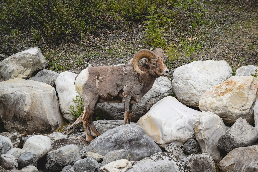
Bighorn SheepColoradoDraw Odds
16 min read·Sep 28, 2026·TAGZ
Bighorn Sheep Altitude Preparation: 2027 Hunt Guide

Why Altitude Matters on a Bighorn Sheep Hunt

Rocky Mountain bighorn sheep commonly inhabit:

Steep, Rocky Mountain Terrain.

Depending on the state, unit and season, hunters may encounter:

  • High elevations

  • Long climbs

  • Steep slopes

  • Talus

  • Cliffs

  • Alpine terrain

  • Rapid weather changes

  • Significant elevation gain

Colorado Parks and Wildlife describes Rocky Mountain bighorn habitat as typically involving:

Steep, high mountain terrain

with rock cover and escape terrain.

That makes physical and altitude preparation especially important.

What Happens to Your Body at High Altitude?

As elevation increases:

Atmospheric Pressure Decreases.

That reduces the partial pressure of oxygen available with each breath.

At approximately:

10,000 Feet

the CDC notes that inspired oxygen partial pressure is only about:

69% of its sea-level value.

That doesn't mean the air contains a different percentage of oxygen.

The atmosphere is still approximately:

21% Oxygen.

Instead, lower atmospheric pressure means fewer oxygen molecules are available with each breath.

Altitude Reduces Performance

Even after acclimatization:

Maximum Exercise Performance Remains Lower at Altitude Than at Low Elevation.

That's important for sheep hunters.

A climb that feels manageable at:

1,000 Feet

can feel dramatically different at:

10,000–12,000 Feet.

Acclimatization helps.

It doesn't turn high elevation into sea level.

Fitness Does Not Prevent Altitude Sickness

This is one of the biggest misconceptions among mountain hunters.

You can be:

Strong

Lean

Fast

and:

Highly Conditioned

and still develop altitude illness.

The CDC specifically notes that:

Physical Fitness Does Not Determine Susceptibility to Altitude Illness.

Training helps you handle:

The Physical Hunt.

Gradual ascent helps your body handle:

The Altitude.

You need both.
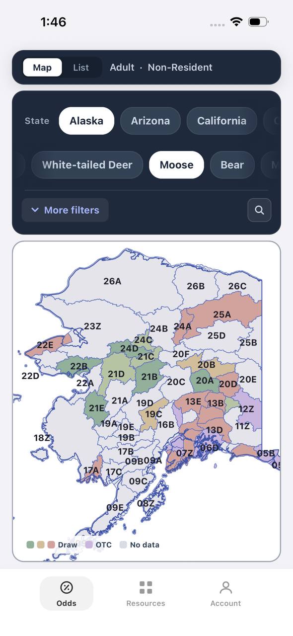
Draw odds
Alaska moose draw odds by unit, colored by draw, OTC, or no data
AdultNonresident

Alaska · Moose

Draw, OTC, and no-data units across the whole state.

Adult, Nonresident, Moose, no additional filters. Every unit is colored by its best matching draw odds; if nothing draws, it shows OTC; if neither, no data.

  • Alaska mixes draw and OTC moose hunts within the same region.
  • Green units are worth an application; purple units are OTC.
  • Filters stay applied when a unit is opened for hunt detail.
Draw odds
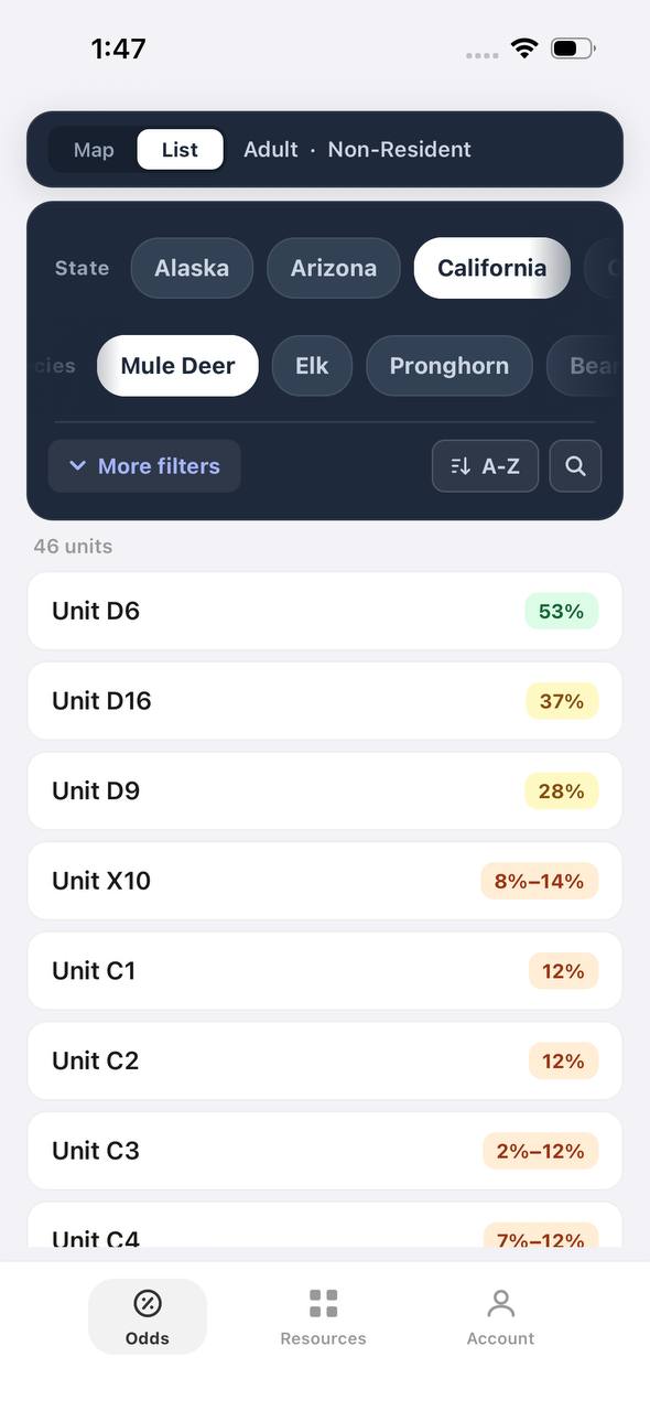
California mule deer draw odds ranked by unit in a list
AdultNonresident

California · Mule deer

Nonresident odds ranked unit by unit.

Adult, Nonresident, Mule deer, no weapon or season chip, so every matching hunt in a zone is combined into one badge and sorted by best projected odds.

  • D6 leads the list; a range like 8%–14% means more than one hunt code exists in that zone.
  • The list and the map read the same filtered hunt set.
  • 46 units are shown for this species and state alone.

Free to join

Download mobile app

  • Detailed draw odds
  • Point tracking
  • Deadline reminders
  • 18 states covered
Download on the App StoreGet it on Google Play
Unit detail
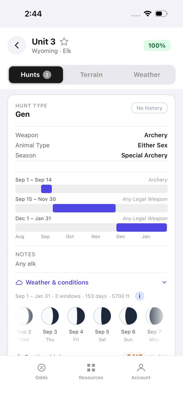
Wyoming elk unit detail, hunts tab, showing hunt windows on a timeline

Wyoming · Elk, Unit 3

Every hunt window inside one unit, laid out on a timeline.

Unit 3 has two hunt codes for elk. Each one shows its weapon, animal type, and season as a bar on a shared Aug–Jan timeline, plus a day-by-day moon phase strip.

  • Archery, then a long Any Legal Weapon window, then a late season — three opportunities in one unit.
  • The 100% badge at top means no real draw competition for the selected filters right now.
  • Weather & conditions expands below the hunt list without leaving the unit.
Terrain data
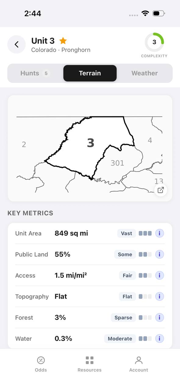
Colorado pronghorn unit detail, terrain tab, showing unit outline and key metrics

Colorado · Pronghorn, Unit 3

Unit boundaries and a complexity score at a glance.

The Terrain tab draws the unit outline against its neighbors and scores it for complexity, then breaks out area, public land, access, topography, forest, and water.

  • 849 sq mi, 55% public land, and flat topography make this a fairly approachable unit.
  • Each metric carries a short rating word — Vast, Some, Fair, Flat, Sparse, Moderate — with a tooltip.
  • The outline map shows adjacent units 2, 4, 13, and 301 for context.
State profiles
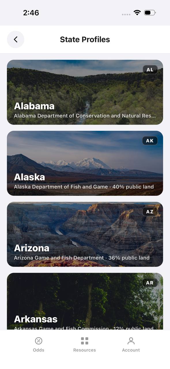
State Profiles screen listing states with wildlife agency and public land percentage

State Profiles

Each state's wildlife agency and public land share, at a glance.

State Profiles lists every covered state as a photo card naming its wildlife agency and, where available, its public land percentage.

  • Public land percentage shows right in the list, before opening the state.
  • Each card names the exact agency the regulations come from.
  • States without a public land figure yet, like Alabama here, are still listed.
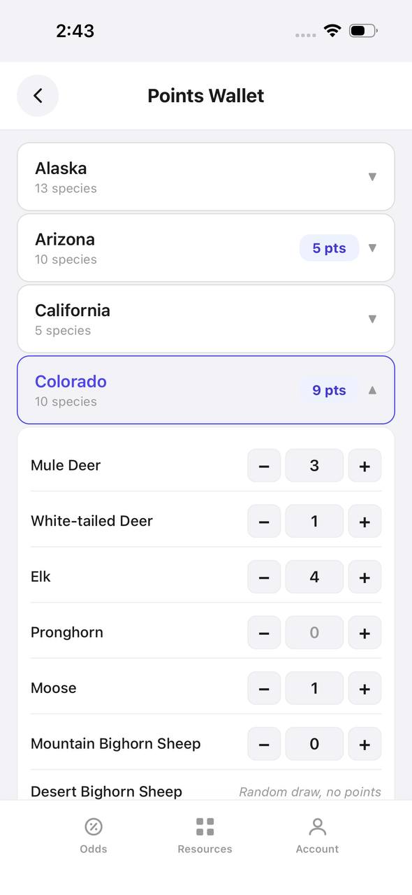
Points wallet
Points Wallet screen with Colorado expanded, showing a point stepper per species

Points Wallet · Colorado

Every state and species point balance in one wallet.

Points Wallet lists each state with a species count; expanding a state, like Colorado here, shows a stepper for every species so a balance can be entered or adjusted directly.

  • Colorado alone tracks points across 10 species independently.
  • Species with no points, like Pronghorn here, still show a zero to stay visible.
  • Desert Bighorn Sheep is flagged as a random draw with no points system.

Free to join

Download mobile app

  • Detailed draw odds
  • Point tracking
  • Deadline reminders
  • 18 states covered
Download on the App StoreGet it on Google Play
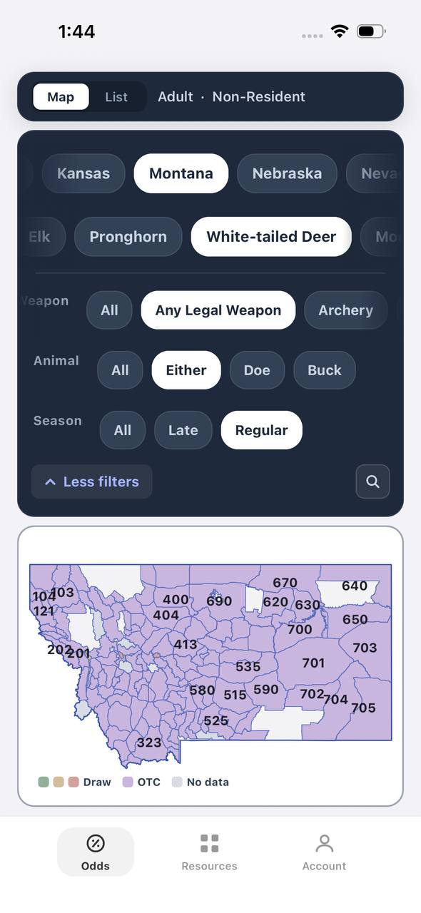
Draw odds
Montana white-tailed deer draw odds filtered to any legal weapon, either sex, regular season
AdultNonresidentAny Legal WeaponEitherRegular

Montana · White-tailed deer

Nearly the whole state is OTC for this filter combination.

Adult, Nonresident, White-tailed deer, filtered to Any Legal Weapon, Either, Regular. Under this combination almost every unit turns purple — over the counter.

  • Switching weapon, sex, or season changes the picture completely.
  • Purple means the tag can be bought directly, no draw.
  • This is the tag-and-go read of Montana whitetail, not the point-based one.
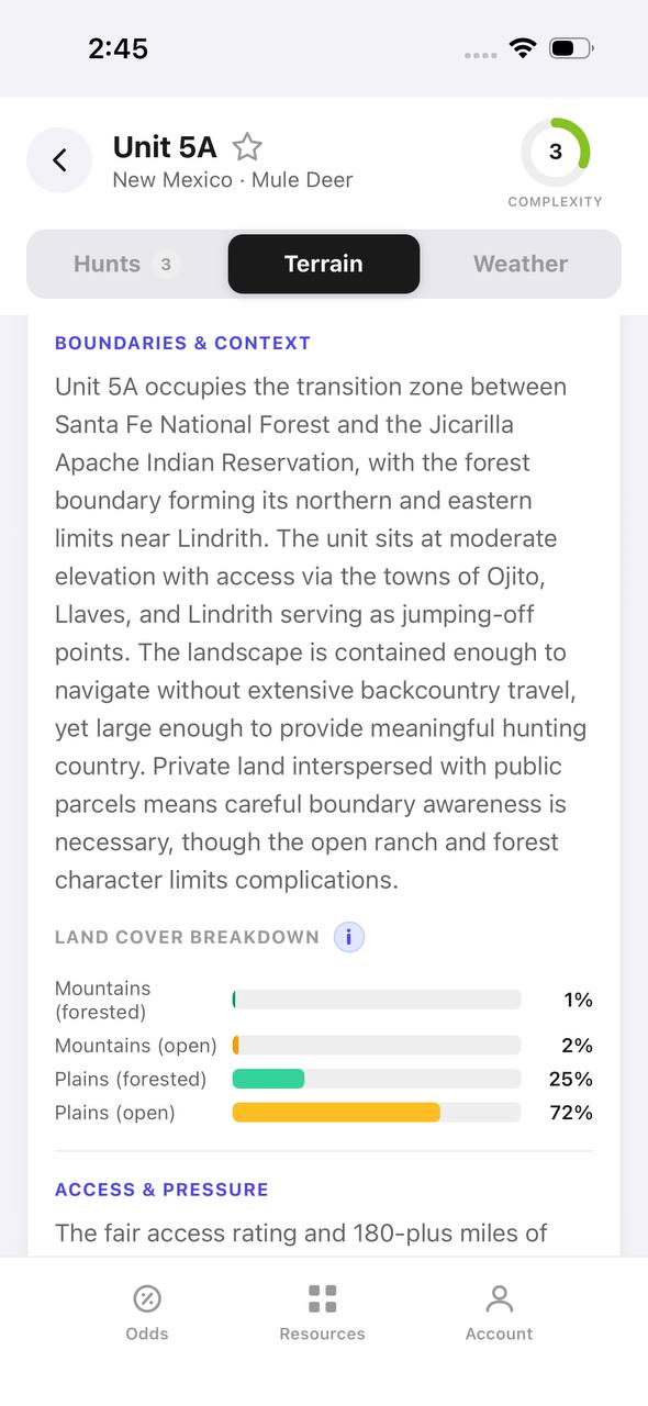
Terrain data
New Mexico mule deer unit 5A terrain tab with boundary description and land cover breakdown

New Mexico · Mule deer, Unit 5A

A written boundary description, not just a shape.

Unit 5A's terrain tab opens with a plain-language paragraph about surrounding land, access towns, and ownership mix, then a land cover breakdown by percentage.

  • 72% open plains and 25% forested plains describe the terrain at a glance.
  • The boundary text calls out the exact reservation and forest lines that define the unit.
  • Access & pressure continues below the fold with mileage detail.
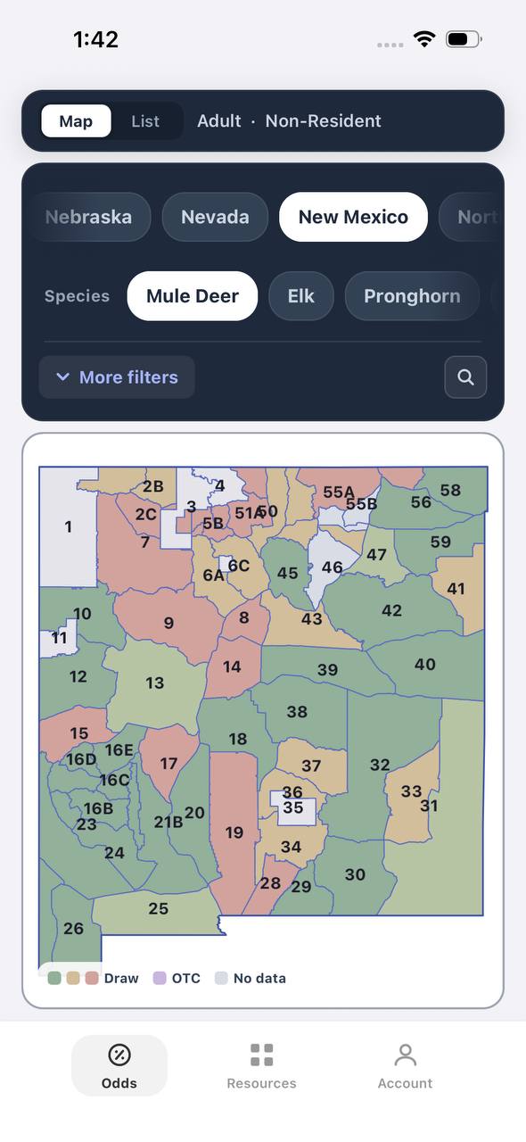
Draw odds
New Mexico mule deer draw odds by unit
AdultNonresident

New Mexico · Mule deer

Mule deer draw odds for every unit in the state.

Adult, Nonresident, Mule deer, all weapons and seasons. Each unit is colored by the same odds calculation used in the dashboard.

  • Green and tan together separate units worth applying to from units that are not.
  • Numbered units follow New Mexico's own game management unit boundaries.
  • Opening a unit shows the exact hunt behind the color.
Favorites
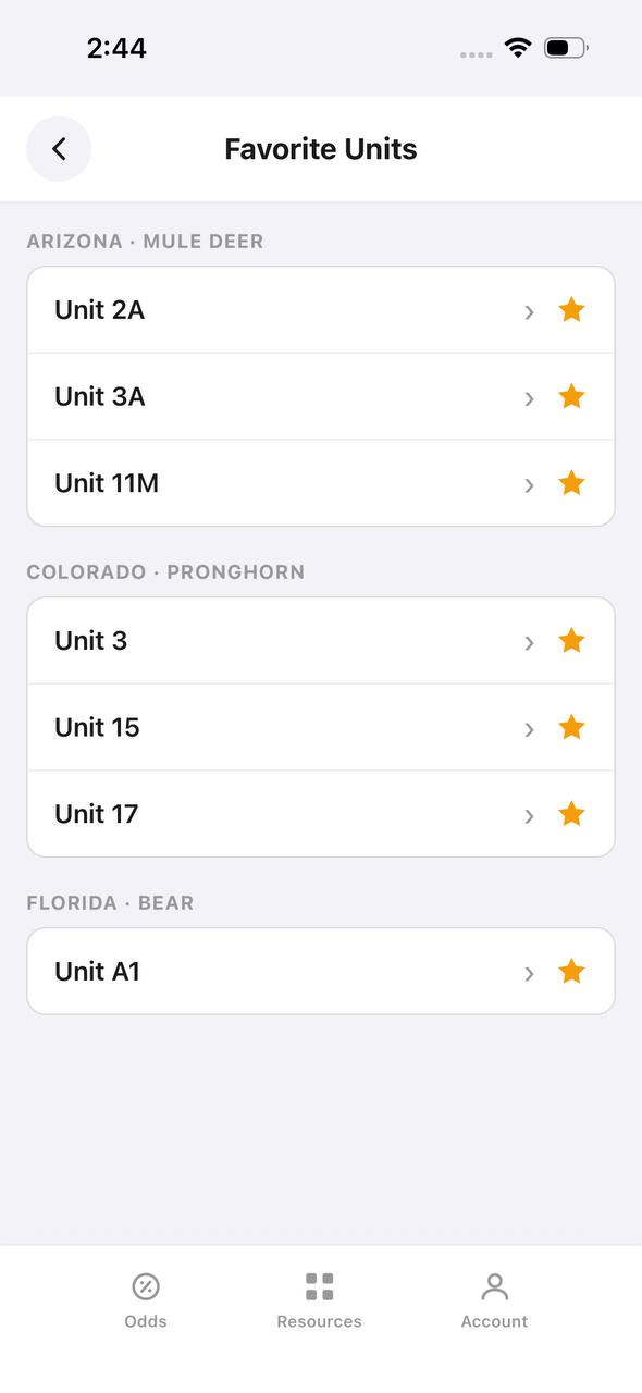
Favorite Units screen grouped by state and species

Favorite Units

Starred units from any state, grouped by species.

Favorite Units collects every starred unit across states and species into one list, grouped by state and species pair, so a saved unit is one tap away.

  • Arizona mule deer and Colorado pronghorn favorites sit side by side here.
  • Each row opens straight into that unit's detail view.
  • Unstarring from this screen removes it from the group instantly.
Deadlines
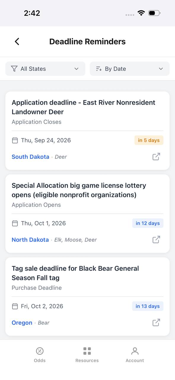
Deadline Reminders screen listing application and purchase deadlines by date

Deadline Reminders

Every application and purchase deadline, sorted by date.

Deadline Reminders filters by state and sorts by date, showing the deadline type, a countdown, and the state and species it applies to, with a link out to the source.

  • Countdown badges shift as a deadline gets close — "in 5 days" here, for example.
  • Application opens and closes are tracked as separate reminder types.
  • Each card links out to confirm the rule at the source.
Interactive map
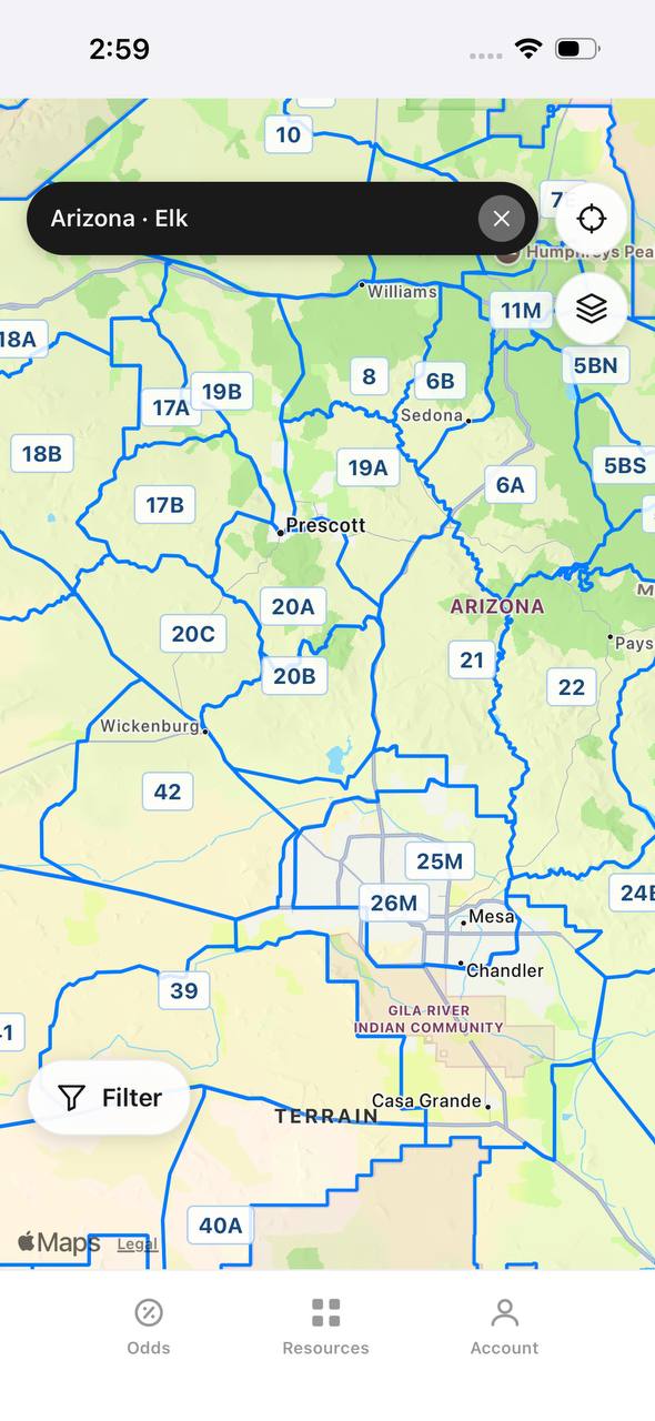
Arizona elk unit boundaries overlaid on an interactive street map

Arizona · Elk

Unit boundaries laid directly over a real map.

This view overlays Arizona elk unit boundaries and labels on top of a street map, with a search bar pinned to state and species and a layer toggle in the corner.

  • Real towns like Prescott and Sedona sit inside their unit boundaries for context.
  • A location button and layer switch float over the map, clear of the unit labels.
  • A Filter button at the bottom opens the same filters used elsewhere in the app.

Free to join

Download mobile app

  • Detailed draw odds
  • Point tracking
  • Deadline reminders
  • 18 states covered
Download on the App StoreGet it on Google Play
Insights
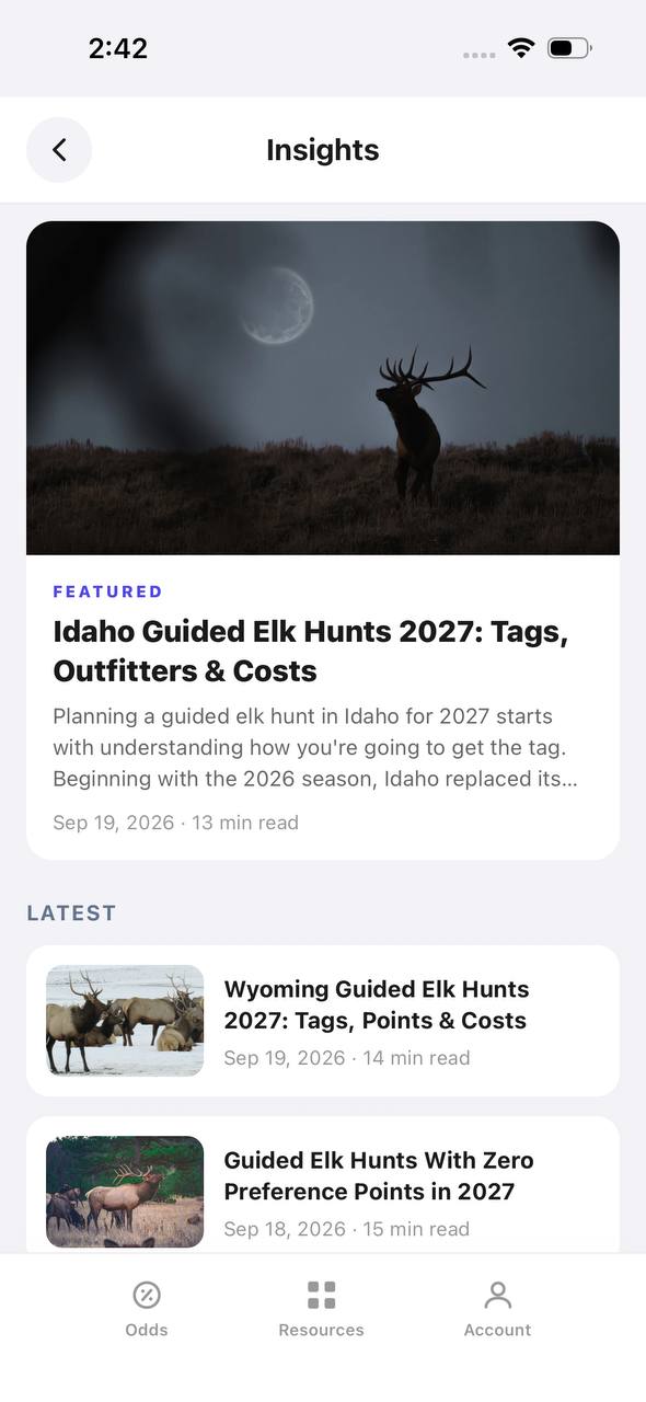
Insights screen with a featured article and a latest articles list

Insights

Hunting articles, built into the app itself.

Insights opens to a featured article with a hero image, then a Latest list of recent posts, each with a thumbnail, read time, and publish date.

  • The featured slot rotates to the newest deep-dive article.
  • Read time and publish date show on every card, not just the featured one.
  • This mirrors the blog content already published on the marketing site.
Download on the App StoreGet it on Google Play

What Elevation Creates Altitude-Sickness Risk?

Any unacclimatized person sleeping around:

8,000 Feet or Higher

can potentially develop altitude illness.

Individual susceptibility varies considerably.

Some hunters tolerate:

10,000 Feet

with relatively few symptoms.

Others can develop symptoms at lower elevations.

Don't assume:

"I've Never Had Altitude Problems Before."

means:

"I Can't Get Altitude Sickness."

Previous Experience Is Useful, Not a Guarantee

Your response to previous high-altitude trips can provide useful information if:

The Elevation + Ascent Rate

were similar.

But even previous success doesn't guarantee you'll react identically on the next hunt.

Weather, illness, sleep, exertion and ascent profile can all differ.

How Long Does Acclimatization Take?

The body's important early acclimatization response occurs primarily during the:

First 3–5 Days After Ascent.

But that doesn't mean every hunter simply needs:

3–5 Days at Hunting Elevation.

A better strategy is:

Stage Your Ascent.

Better Than "Arrive 3–5 Days Early"

The original recommendation was:

Spend 3–5 Days at or Above the Elevation You'll Hunt.

That's too simplistic.

If you're coming directly from near sea level and hunting at:

11,000–13,000 Feet,

immediately sleeping at that elevation isn't ideal acclimatization.

Instead:

Increase Sleeping Elevation Gradually.

A Better Acclimatization Strategy

When practical, the CDC recommends spending:

At Least 2–3 Nights Around 8,000–9,000 Feet

before proceeding substantially higher.

Then, once above roughly:

9,800 Feet,

limit additional sleeping-elevation gain to approximately:

1,600 Feet Per Day.

Add an extra acclimatization day for approximately every:

3,300 Feet

of additional sleeping elevation.

Individual tolerance still varies.

Example: Low-Elevation Hunter Going to 11,500 Feet

Suppose you're traveling from:

1,000 Feet

and expect to hunt around:

10,000–12,000 Feet.

A better itinerary might be:

Day 1–2

Sleep around 8,000–9,000 feet.

Keep activity relatively easy.

Day 3

Move higher if you're feeling well.

Day 4+

Continue gradually increasing sleeping elevation while monitoring symptoms.

The exact schedule should match:

Your Hunt + Camp Elevation + Access + Personal History.

Sleeping Elevation Matters

Altitude recommendations often focus on:

Sleeping Elevation

rather than simply the highest point reached during the day.

You may be able to:

Hike Higher During the Day

and then:

Sleep Lower.

That can be easier on your body than moving your sleeping elevation upward too rapidly.

Pre-Hunt Altitude Exposure Can Help

If you have access to mountains before your hunt, recent altitude exposure can be useful.

The CDC notes that spending:

Two or More Nights Above Approximately 9,000 Feet

during the weeks before a trip can provide some benefit.

Closer to the actual hunt is generally better.

Altitude Training Masks Aren't the Same Thing

Don't confuse:

Restricted-Breathing Training Masks

with:

Altitude Acclimatization.

A mask that makes breathing harder doesn't recreate the lower oxygen partial pressure experienced at actual altitude.

Use training masks only for whatever specific training benefit you're pursuing—not as proof that you're acclimatized.

Train for the Mountain

Your fitness program should prepare you for:

Steep Terrain + Elevation Gain + Long Days + Load Carrying.

A strong program can include:

  • Hiking

  • Incline treadmill

  • Stair climbing

  • Running

  • Cycling

  • Step-ups

  • Strength training

  • Loaded hiking

The best program is one you can:

Progressively Build and Recover From.

Aerobic Conditioning

Bighorn sheep hunting can involve hours of:

Sustained Submaximal Effort.

Build a strong aerobic base with activities such as:

  • Hiking

  • Incline walking

  • Cycling

  • Running

  • Stair climbing

You should be comfortable maintaining:

Steady Effort for Extended Periods.

Uphill Conditioning

Flat-road running alone doesn't fully replicate:

Mountain Climbing.

Add vertical work.

Useful options include:

Incline Treadmill

Stair Climber

Hill Repeats

and:

Mountain Hiking.

Progress gradually rather than dramatically increasing vertical volume all at once.

Strength Training

Prioritize movements that support:

Climbing + Descending + Stabilization + Load Carrying.

Examples include:

  • Squats

  • Split squats

  • Lunges

  • Step-ups

  • Deadlift variations

  • Calf raises

  • Rows

  • Carries

  • Core stabilization

You don't need to become a powerlifter.

You need:

Useful Mountain Strength.

Train the Descent Too

Hunters often train:

Uphill

and forget:

Downhill.

Long descents can heavily load the:

Quadriceps + Knees + Ankles.

Progressive downhill hiking can help prepare your legs for eccentric loading.

Don't introduce massive downhill volume immediately before your hunt.

Draw odds
Alaska moose draw odds by unit, colored by draw, OTC, or no data
AdultNonresident

Alaska · Moose

Draw, OTC, and no-data units across the whole state.

Adult, Nonresident, Moose, no additional filters. Every unit is colored by its best matching draw odds; if nothing draws, it shows OTC; if neither, no data.

  • Alaska mixes draw and OTC moose hunts within the same region.
  • Green units are worth an application; purple units are OTC.
  • Filters stay applied when a unit is opened for hunt detail.
Draw odds
California mule deer draw odds ranked by unit in a list
AdultNonresident

California · Mule deer

Nonresident odds ranked unit by unit.

Adult, Nonresident, Mule deer, no weapon or season chip, so every matching hunt in a zone is combined into one badge and sorted by best projected odds.

  • D6 leads the list; a range like 8%–14% means more than one hunt code exists in that zone.
  • The list and the map read the same filtered hunt set.
  • 46 units are shown for this species and state alone.

Free to join

Download mobile app

  • Detailed draw odds
  • Point tracking
  • Deadline reminders
  • 18 states covered
Download on the App StoreGet it on Google Play
Unit detail
Wyoming elk unit detail, hunts tab, showing hunt windows on a timeline

Wyoming · Elk, Unit 3

Every hunt window inside one unit, laid out on a timeline.

Unit 3 has two hunt codes for elk. Each one shows its weapon, animal type, and season as a bar on a shared Aug–Jan timeline, plus a day-by-day moon phase strip.

  • Archery, then a long Any Legal Weapon window, then a late season — three opportunities in one unit.
  • The 100% badge at top means no real draw competition for the selected filters right now.
  • Weather & conditions expands below the hunt list without leaving the unit.
Terrain data
Colorado pronghorn unit detail, terrain tab, showing unit outline and key metrics

Colorado · Pronghorn, Unit 3

Unit boundaries and a complexity score at a glance.

The Terrain tab draws the unit outline against its neighbors and scores it for complexity, then breaks out area, public land, access, topography, forest, and water.

  • 849 sq mi, 55% public land, and flat topography make this a fairly approachable unit.
  • Each metric carries a short rating word — Vast, Some, Fair, Flat, Sparse, Moderate — with a tooltip.
  • The outline map shows adjacent units 2, 4, 13, and 301 for context.
State profiles
State Profiles screen listing states with wildlife agency and public land percentage

State Profiles

Each state's wildlife agency and public land share, at a glance.

State Profiles lists every covered state as a photo card naming its wildlife agency and, where available, its public land percentage.

  • Public land percentage shows right in the list, before opening the state.
  • Each card names the exact agency the regulations come from.
  • States without a public land figure yet, like Alabama here, are still listed.
Points wallet
Points Wallet screen with Colorado expanded, showing a point stepper per species

Points Wallet · Colorado

Every state and species point balance in one wallet.

Points Wallet lists each state with a species count; expanding a state, like Colorado here, shows a stepper for every species so a balance can be entered or adjusted directly.

  • Colorado alone tracks points across 10 species independently.
  • Species with no points, like Pronghorn here, still show a zero to stay visible.
  • Desert Bighorn Sheep is flagged as a random draw with no points system.

Free to join

Download mobile app

  • Detailed draw odds
  • Point tracking
  • Deadline reminders
  • 18 states covered
Download on the App StoreGet it on Google Play
Draw odds
Montana white-tailed deer draw odds filtered to any legal weapon, either sex, regular season
AdultNonresidentAny Legal WeaponEitherRegular

Montana · White-tailed deer

Nearly the whole state is OTC for this filter combination.

Adult, Nonresident, White-tailed deer, filtered to Any Legal Weapon, Either, Regular. Under this combination almost every unit turns purple — over the counter.

  • Switching weapon, sex, or season changes the picture completely.
  • Purple means the tag can be bought directly, no draw.
  • This is the tag-and-go read of Montana whitetail, not the point-based one.
Terrain data
New Mexico mule deer unit 5A terrain tab with boundary description and land cover breakdown

New Mexico · Mule deer, Unit 5A

A written boundary description, not just a shape.

Unit 5A's terrain tab opens with a plain-language paragraph about surrounding land, access towns, and ownership mix, then a land cover breakdown by percentage.

  • 72% open plains and 25% forested plains describe the terrain at a glance.
  • The boundary text calls out the exact reservation and forest lines that define the unit.
  • Access & pressure continues below the fold with mileage detail.
Draw odds
New Mexico mule deer draw odds by unit
AdultNonresident

New Mexico · Mule deer

Mule deer draw odds for every unit in the state.

Adult, Nonresident, Mule deer, all weapons and seasons. Each unit is colored by the same odds calculation used in the dashboard.

  • Green and tan together separate units worth applying to from units that are not.
  • Numbered units follow New Mexico's own game management unit boundaries.
  • Opening a unit shows the exact hunt behind the color.
Favorites
Favorite Units screen grouped by state and species

Favorite Units

Starred units from any state, grouped by species.

Favorite Units collects every starred unit across states and species into one list, grouped by state and species pair, so a saved unit is one tap away.

  • Arizona mule deer and Colorado pronghorn favorites sit side by side here.
  • Each row opens straight into that unit's detail view.
  • Unstarring from this screen removes it from the group instantly.
Deadlines
Deadline Reminders screen listing application and purchase deadlines by date

Deadline Reminders

Every application and purchase deadline, sorted by date.

Deadline Reminders filters by state and sorts by date, showing the deadline type, a countdown, and the state and species it applies to, with a link out to the source.

  • Countdown badges shift as a deadline gets close — "in 5 days" here, for example.
  • Application opens and closes are tracked as separate reminder types.
  • Each card links out to confirm the rule at the source.
Interactive map
Arizona elk unit boundaries overlaid on an interactive street map

Arizona · Elk

Unit boundaries laid directly over a real map.

This view overlays Arizona elk unit boundaries and labels on top of a street map, with a search bar pinned to state and species and a layer toggle in the corner.

  • Real towns like Prescott and Sedona sit inside their unit boundaries for context.
  • A location button and layer switch float over the map, clear of the unit labels.
  • A Filter button at the bottom opens the same filters used elsewhere in the app.

Free to join

Download mobile app

  • Detailed draw odds
  • Point tracking
  • Deadline reminders
  • 18 states covered
Download on the App StoreGet it on Google Play
Insights
Insights screen with a featured article and a latest articles list

Insights

Hunting articles, built into the app itself.

Insights opens to a featured article with a hero image, then a Latest list of recent posts, each with a thumbnail, read time, and publish date.

  • The featured slot rotates to the newest deep-dive article.
  • Read time and publish date show on every card, not just the featured one.
  • This mirrors the blog content already published on the marketing site.
Download on the App StoreGet it on Google Play

Train With a Pack Gradually

If your hunt requires carrying a pack:

Train With One.

But don't begin with extremely heavy loads.

Progress:

Time + Distance + Vertical Gain + Pack Weight

gradually.

Your joints and connective tissue need time to adapt.

Don't Destroy Your Knees Training for the Hunt

More weight isn't automatically better training.

Repeatedly carrying unnecessarily heavy loads can increase injury risk without providing proportional benefit.

Build toward:

Realistic Hunting Loads.

Save extreme pack-outs for:

The Actual Pack-Out.

Balance and Stability

Bighorn country can involve:

Loose Rock + Talus + Uneven Ground + Steep Slopes.

Include exercises that develop:

  • Single-leg strength

  • Ankle stability

  • Hip stability

  • Balance

  • Core control

These can help you move more confidently through irregular terrain.

Hydration at Altitude

Stay adequately hydrated.

High-altitude environments can increase:

Respiratory Water Loss

and dehydration can make you feel worse.

But don't oversimplify this into:

"Drink More Water to Prevent Altitude Sickness."

Hydration does not replace acclimatization.

And excessive water intake can create its own problems.

Aim for:

Normal Adequate Hydration

rather than forcing extreme quantities of water.

Hydration Doesn't Cure AMS

This distinction matters.

Dehydration can cause symptoms that resemble or worsen how you feel at altitude.

But:

Acute Mountain Sickness Is Caused by Hypoxic Exposure—not Simply Dehydration.

Drinking water won't compensate for:

Ascending Too High Too Fast.

Nutrition at Altitude

Maintain adequate:

Calories + Carbohydrates + Protein + Fluids.

High-altitude hunts can dramatically increase daily energy demands because of:

Cold + Vertical Gain + Long Hunting Days.

Carbohydrate-rich foods can be useful for maintaining energy during hard mountain activity.

Pack food you know you'll actually eat when:

Tired + Cold + Working Hard.

Alcohol at Altitude

Avoid alcohol during the initial acclimatization period.

Current CDC guidance recommends avoiding alcohol for approximately:

The First 48 Hours at High Altitude.

Alcohol can interfere with sleep and physiological responses to altitude.

What About Caffeine?

You don't necessarily need to stop drinking coffee.

In fact, habitual caffeine users who suddenly stop can develop:

Caffeine-Withdrawal Headaches.

That can make distinguishing:

Withdrawal

from:

Altitude Headache

more difficult.

Moderate your intake rather than assuming all caffeine must be eliminated.

Take It Easy During the First 48 Hours

Don't arrive at altitude and immediately attempt:

The Hardest Climb of the Hunt.

CDC guidance recommends:

Mild Exercise During the First 48 Hours

at altitude.

Use those first days for:

  • Easy scouting

  • Glassing

  • Gear preparation

  • Short hikes

  • Adjusting camp

Then increase workload as your body adapts.

Recognizing Acute Mountain Sickness

Acute Mountain Sickness:

AMS

commonly includes:

Headache

along with symptoms such as:

  • Nausea

  • Dizziness

  • Fatigue

  • Reduced appetite

  • Sleep disturbance

Don't automatically dismiss these symptoms as:

Being Out of Shape.

The Golden Rule of Altitude Illness

A simple field principle is:

Don't Ascend Higher With Worsening Altitude Symptoms.

If symptoms worsen:

Stop Ascending.

If serious symptoms develop:

Descend and Seek Medical Help.

Severe Altitude Illness

Two potentially life-threatening conditions are:

High-Altitude Cerebral Edema — HACE

and:

High-Altitude Pulmonary Edema — HAPE.

These are medical emergencies.

Warning Signs of HACE

Possible HACE symptoms include:

  • Confusion

  • Altered mental status

  • Severe drowsiness

  • Loss of coordination

  • Difficulty walking normally

A hunter acting:

Drunk Without Alcohol

at high altitude should be taken extremely seriously.

Draw odds
Alaska moose draw odds by unit, colored by draw, OTC, or no data
AdultNonresident

Alaska · Moose

Draw, OTC, and no-data units across the whole state.

Adult, Nonresident, Moose, no additional filters. Every unit is colored by its best matching draw odds; if nothing draws, it shows OTC; if neither, no data.

  • Alaska mixes draw and OTC moose hunts within the same region.
  • Green units are worth an application; purple units are OTC.
  • Filters stay applied when a unit is opened for hunt detail.
Draw odds
California mule deer draw odds ranked by unit in a list
AdultNonresident

California · Mule deer

Nonresident odds ranked unit by unit.

Adult, Nonresident, Mule deer, no weapon or season chip, so every matching hunt in a zone is combined into one badge and sorted by best projected odds.

  • D6 leads the list; a range like 8%–14% means more than one hunt code exists in that zone.
  • The list and the map read the same filtered hunt set.
  • 46 units are shown for this species and state alone.

Free to join

Download mobile app

  • Detailed draw odds
  • Point tracking
  • Deadline reminders
  • 18 states covered
Download on the App StoreGet it on Google Play
Unit detail
Wyoming elk unit detail, hunts tab, showing hunt windows on a timeline

Wyoming · Elk, Unit 3

Every hunt window inside one unit, laid out on a timeline.

Unit 3 has two hunt codes for elk. Each one shows its weapon, animal type, and season as a bar on a shared Aug–Jan timeline, plus a day-by-day moon phase strip.

  • Archery, then a long Any Legal Weapon window, then a late season — three opportunities in one unit.
  • The 100% badge at top means no real draw competition for the selected filters right now.
  • Weather & conditions expands below the hunt list without leaving the unit.
Terrain data
Colorado pronghorn unit detail, terrain tab, showing unit outline and key metrics

Colorado · Pronghorn, Unit 3

Unit boundaries and a complexity score at a glance.

The Terrain tab draws the unit outline against its neighbors and scores it for complexity, then breaks out area, public land, access, topography, forest, and water.

  • 849 sq mi, 55% public land, and flat topography make this a fairly approachable unit.
  • Each metric carries a short rating word — Vast, Some, Fair, Flat, Sparse, Moderate — with a tooltip.
  • The outline map shows adjacent units 2, 4, 13, and 301 for context.
State profiles
State Profiles screen listing states with wildlife agency and public land percentage

State Profiles

Each state's wildlife agency and public land share, at a glance.

State Profiles lists every covered state as a photo card naming its wildlife agency and, where available, its public land percentage.

  • Public land percentage shows right in the list, before opening the state.
  • Each card names the exact agency the regulations come from.
  • States without a public land figure yet, like Alabama here, are still listed.
Points wallet
Points Wallet screen with Colorado expanded, showing a point stepper per species

Points Wallet · Colorado

Every state and species point balance in one wallet.

Points Wallet lists each state with a species count; expanding a state, like Colorado here, shows a stepper for every species so a balance can be entered or adjusted directly.

  • Colorado alone tracks points across 10 species independently.
  • Species with no points, like Pronghorn here, still show a zero to stay visible.
  • Desert Bighorn Sheep is flagged as a random draw with no points system.

Free to join

Download mobile app

  • Detailed draw odds
  • Point tracking
  • Deadline reminders
  • 18 states covered
Download on the App StoreGet it on Google Play
Draw odds
Montana white-tailed deer draw odds filtered to any legal weapon, either sex, regular season
AdultNonresidentAny Legal WeaponEitherRegular

Montana · White-tailed deer

Nearly the whole state is OTC for this filter combination.

Adult, Nonresident, White-tailed deer, filtered to Any Legal Weapon, Either, Regular. Under this combination almost every unit turns purple — over the counter.

  • Switching weapon, sex, or season changes the picture completely.
  • Purple means the tag can be bought directly, no draw.
  • This is the tag-and-go read of Montana whitetail, not the point-based one.
Terrain data
New Mexico mule deer unit 5A terrain tab with boundary description and land cover breakdown

New Mexico · Mule deer, Unit 5A

A written boundary description, not just a shape.

Unit 5A's terrain tab opens with a plain-language paragraph about surrounding land, access towns, and ownership mix, then a land cover breakdown by percentage.

  • 72% open plains and 25% forested plains describe the terrain at a glance.
  • The boundary text calls out the exact reservation and forest lines that define the unit.
  • Access & pressure continues below the fold with mileage detail.
Draw odds
New Mexico mule deer draw odds by unit
AdultNonresident

New Mexico · Mule deer

Mule deer draw odds for every unit in the state.

Adult, Nonresident, Mule deer, all weapons and seasons. Each unit is colored by the same odds calculation used in the dashboard.

  • Green and tan together separate units worth applying to from units that are not.
  • Numbered units follow New Mexico's own game management unit boundaries.
  • Opening a unit shows the exact hunt behind the color.
Favorites
Favorite Units screen grouped by state and species

Favorite Units

Starred units from any state, grouped by species.

Favorite Units collects every starred unit across states and species into one list, grouped by state and species pair, so a saved unit is one tap away.

  • Arizona mule deer and Colorado pronghorn favorites sit side by side here.
  • Each row opens straight into that unit's detail view.
  • Unstarring from this screen removes it from the group instantly.
Deadlines
Deadline Reminders screen listing application and purchase deadlines by date

Deadline Reminders

Every application and purchase deadline, sorted by date.

Deadline Reminders filters by state and sorts by date, showing the deadline type, a countdown, and the state and species it applies to, with a link out to the source.

  • Countdown badges shift as a deadline gets close — "in 5 days" here, for example.
  • Application opens and closes are tracked as separate reminder types.
  • Each card links out to confirm the rule at the source.
Interactive map
Arizona elk unit boundaries overlaid on an interactive street map

Arizona · Elk

Unit boundaries laid directly over a real map.

This view overlays Arizona elk unit boundaries and labels on top of a street map, with a search bar pinned to state and species and a layer toggle in the corner.

  • Real towns like Prescott and Sedona sit inside their unit boundaries for context.
  • A location button and layer switch float over the map, clear of the unit labels.
  • A Filter button at the bottom opens the same filters used elsewhere in the app.

Free to join

Download mobile app

  • Detailed draw odds
  • Point tracking
  • Deadline reminders
  • 18 states covered
Download on the App StoreGet it on Google Play
Insights
Insights screen with a featured article and a latest articles list

Insights

Hunting articles, built into the app itself.

Insights opens to a featured article with a hero image, then a Latest list of recent posts, each with a thumbnail, read time, and publish date.

  • The featured slot rotates to the newest deep-dive article.
  • Read time and publish date show on every card, not just the featured one.
  • This mirrors the blog content already published on the marketing site.
Download on the App StoreGet it on Google Play

Warning Signs of HAPE

Possible HAPE signs can include:

  • Marked shortness of breath

  • Reduced exercise ability

  • Cough

  • Chest congestion

  • Shortness of breath at rest

  • Rapid deterioration

Don't try to:

Tough It Out.

Descent Can Be Lifesaving

For serious altitude illness:

Descent Is One of the Most Important Treatments.

The CDC notes that even descending approximately:

1,000 Feet

can produce rapid improvement in AMS.

For suspected HACE or HAPE:

Urgent Descent + Medical Treatment

may be necessary.

Don't Hunt Through Serious Symptoms

A once-in-a-lifetime sheep tag can create enormous pressure to:

Keep Going.

Don't let tag rarity override safety.

If symptoms are worsening:

The Ram Can Wait.

Continuing higher can turn a manageable problem into an emergency.

What About Portable Oxygen?

The original article recommends:

Portable Oxygen

for hunters with previous altitude sickness.

That needs important clarification.

Medical supplemental oxygen can be extremely useful in:

Treating Altitude Illness.

But small recreational:

Handheld Oxygen Cans

contain too little oxygen for sustained treatment.

The CDC specifically notes that these small cans may provide brief relief but don't contain enough oxygen for:

Sustained Improvement.

Oxygen Isn't a Substitute for Acclimatization

Don't plan:

Rapid Ascent + Oxygen Can

as your altitude strategy.

Proper planning should prioritize:

Gradual Ascent.

For serious illness:

Descent + Medical Evaluation + Appropriate Treatment

take priority.

Previous HAPE or HACE Requires More Planning

If you've previously experienced:

HAPE

HACE

or:

Severe AMS,

discuss your itinerary with a clinician familiar with:

High-Altitude Medicine

before the hunt.

Your prevention plan may need to be more conservative.

What About Acetazolamide?

Acetazolamide is a prescription medication that can:

Speed Acclimatization

and reduce the risk of AMS in appropriate circumstances.

It's particularly worth discussing with a clinician when:

Gradual Ascent Isn't Practical

or:

Your Previous Altitude History Raises Concern.

Don't self-prescribe based on a hunting blog.

Acetazolamide Doesn't Replace Smart Ascent

Medication can help.

It doesn't mean:

Fly From Sea Level → Sleep at 12,000 Feet → Hunt Hard Immediately.

Your ascent profile remains important.

Sleep Matters

Sleep often becomes disrupted at altitude.

Above roughly:

9,000 Feet

periodic breathing becomes common.

Hunters may experience:

Frequent Awakenings + Poor Sleep Quality.

Give yourself time to acclimatize rather than interpreting the first bad night as proof that:

You Can't Handle Altitude.

Avoid Respiratory Depressants

Certain medications and substances can interfere with breathing responses at altitude.

If you take:

Prescription Medications

or have:

Heart/Lung Conditions

discuss high-altitude travel with your clinician before the hunt.

Don't discontinue prescribed medication based on general internet advice.

Should You Carry a Pulse Oximeter?

A small fingertip pulse oximeter can provide:

Supplemental Information.

But don't use one number as your entire decision-making system.

Normal oxygen saturation decreases with elevation.

Your:

Symptoms + Behavior + Coordination + Breathing

remain extremely important.

Weather Is Another High-Altitude Hazard

Altitude isn't the only concern on a sheep hunt.

Mountain environments can produce:

  • Hypothermia

  • Lightning

  • Snow

  • Wind

  • Rapid temperature changes

  • Whiteouts

  • Wet conditions

  • Poor visibility

Prepare for:

The Mountain

not just:

Low Oxygen.

Layering System

A useful clothing system generally includes:

Moisture Management

Insulation

and:

Weather Protection.

Your exact setup should match:

Season + State + Elevation + Forecast.

Avoid cotton-heavy systems for demanding backcountry conditions where staying dry matters.

Footwear

Bighorn country demands:

Traction + Stability + Fit.

Break boots in before the hunt.

Don't begin a sheep hunt with:

Brand-New Boots You've Never Worn.

Blisters can end a hunt almost as effectively as poor conditioning.

Draw odds
Alaska moose draw odds by unit, colored by draw, OTC, or no data
AdultNonresident

Alaska · Moose

Draw, OTC, and no-data units across the whole state.

Adult, Nonresident, Moose, no additional filters. Every unit is colored by its best matching draw odds; if nothing draws, it shows OTC; if neither, no data.

  • Alaska mixes draw and OTC moose hunts within the same region.
  • Green units are worth an application; purple units are OTC.
  • Filters stay applied when a unit is opened for hunt detail.
Draw odds
California mule deer draw odds ranked by unit in a list
AdultNonresident

California · Mule deer

Nonresident odds ranked unit by unit.

Adult, Nonresident, Mule deer, no weapon or season chip, so every matching hunt in a zone is combined into one badge and sorted by best projected odds.

  • D6 leads the list; a range like 8%–14% means more than one hunt code exists in that zone.
  • The list and the map read the same filtered hunt set.
  • 46 units are shown for this species and state alone.

Free to join

Download mobile app

  • Detailed draw odds
  • Point tracking
  • Deadline reminders
  • 18 states covered
Download on the App StoreGet it on Google Play
Unit detail
Wyoming elk unit detail, hunts tab, showing hunt windows on a timeline

Wyoming · Elk, Unit 3

Every hunt window inside one unit, laid out on a timeline.

Unit 3 has two hunt codes for elk. Each one shows its weapon, animal type, and season as a bar on a shared Aug–Jan timeline, plus a day-by-day moon phase strip.

  • Archery, then a long Any Legal Weapon window, then a late season — three opportunities in one unit.
  • The 100% badge at top means no real draw competition for the selected filters right now.
  • Weather & conditions expands below the hunt list without leaving the unit.
Terrain data
Colorado pronghorn unit detail, terrain tab, showing unit outline and key metrics

Colorado · Pronghorn, Unit 3

Unit boundaries and a complexity score at a glance.

The Terrain tab draws the unit outline against its neighbors and scores it for complexity, then breaks out area, public land, access, topography, forest, and water.

  • 849 sq mi, 55% public land, and flat topography make this a fairly approachable unit.
  • Each metric carries a short rating word — Vast, Some, Fair, Flat, Sparse, Moderate — with a tooltip.
  • The outline map shows adjacent units 2, 4, 13, and 301 for context.
State profiles
State Profiles screen listing states with wildlife agency and public land percentage

State Profiles

Each state's wildlife agency and public land share, at a glance.

State Profiles lists every covered state as a photo card naming its wildlife agency and, where available, its public land percentage.

  • Public land percentage shows right in the list, before opening the state.
  • Each card names the exact agency the regulations come from.
  • States without a public land figure yet, like Alabama here, are still listed.
Points wallet
Points Wallet screen with Colorado expanded, showing a point stepper per species

Points Wallet · Colorado

Every state and species point balance in one wallet.

Points Wallet lists each state with a species count; expanding a state, like Colorado here, shows a stepper for every species so a balance can be entered or adjusted directly.

  • Colorado alone tracks points across 10 species independently.
  • Species with no points, like Pronghorn here, still show a zero to stay visible.
  • Desert Bighorn Sheep is flagged as a random draw with no points system.

Free to join

Download mobile app

  • Detailed draw odds
  • Point tracking
  • Deadline reminders
  • 18 states covered
Download on the App StoreGet it on Google Play
Draw odds
Montana white-tailed deer draw odds filtered to any legal weapon, either sex, regular season
AdultNonresidentAny Legal WeaponEitherRegular

Montana · White-tailed deer

Nearly the whole state is OTC for this filter combination.

Adult, Nonresident, White-tailed deer, filtered to Any Legal Weapon, Either, Regular. Under this combination almost every unit turns purple — over the counter.

  • Switching weapon, sex, or season changes the picture completely.
  • Purple means the tag can be bought directly, no draw.
  • This is the tag-and-go read of Montana whitetail, not the point-based one.
Terrain data
New Mexico mule deer unit 5A terrain tab with boundary description and land cover breakdown

New Mexico · Mule deer, Unit 5A

A written boundary description, not just a shape.

Unit 5A's terrain tab opens with a plain-language paragraph about surrounding land, access towns, and ownership mix, then a land cover breakdown by percentage.

  • 72% open plains and 25% forested plains describe the terrain at a glance.
  • The boundary text calls out the exact reservation and forest lines that define the unit.
  • Access & pressure continues below the fold with mileage detail.
Draw odds
New Mexico mule deer draw odds by unit
AdultNonresident

New Mexico · Mule deer

Mule deer draw odds for every unit in the state.

Adult, Nonresident, Mule deer, all weapons and seasons. Each unit is colored by the same odds calculation used in the dashboard.

  • Green and tan together separate units worth applying to from units that are not.
  • Numbered units follow New Mexico's own game management unit boundaries.
  • Opening a unit shows the exact hunt behind the color.
Favorites
Favorite Units screen grouped by state and species

Favorite Units

Starred units from any state, grouped by species.

Favorite Units collects every starred unit across states and species into one list, grouped by state and species pair, so a saved unit is one tap away.

  • Arizona mule deer and Colorado pronghorn favorites sit side by side here.
  • Each row opens straight into that unit's detail view.
  • Unstarring from this screen removes it from the group instantly.
Deadlines
Deadline Reminders screen listing application and purchase deadlines by date

Deadline Reminders

Every application and purchase deadline, sorted by date.

Deadline Reminders filters by state and sorts by date, showing the deadline type, a countdown, and the state and species it applies to, with a link out to the source.

  • Countdown badges shift as a deadline gets close — "in 5 days" here, for example.
  • Application opens and closes are tracked as separate reminder types.
  • Each card links out to confirm the rule at the source.
Interactive map
Arizona elk unit boundaries overlaid on an interactive street map

Arizona · Elk

Unit boundaries laid directly over a real map.

This view overlays Arizona elk unit boundaries and labels on top of a street map, with a search bar pinned to state and species and a layer toggle in the corner.

  • Real towns like Prescott and Sedona sit inside their unit boundaries for context.
  • A location button and layer switch float over the map, clear of the unit labels.
  • A Filter button at the bottom opens the same filters used elsewhere in the app.

Free to join

Download mobile app

  • Detailed draw odds
  • Point tracking
  • Deadline reminders
  • 18 states covered
Download on the App StoreGet it on Google Play
Insights
Insights screen with a featured article and a latest articles list

Insights

Hunting articles, built into the app itself.

Insights opens to a featured article with a hero image, then a Latest list of recent posts, each with a thumbnail, read time, and publish date.

  • The featured slot rotates to the newest deep-dive article.
  • Read time and publish date show on every card, not just the featured one.
  • This mirrors the blog content already published on the marketing site.
Download on the App StoreGet it on Google Play

Trekking Poles

Trekking poles can be useful for:

Steep Climbs

Descents

Loose Terrain

and:

Heavy Packs.

They can also improve stability when crossing irregular mountain terrain.

Navigation

Carry redundant navigation appropriate for the hunt:

Offline Mapping

plus:

Backup Navigation.

Don't depend entirely on:

Cell Service.

Mountain terrain can quickly eliminate reception.

Emergency Communication

For remote sheep country, consider:

Satellite Communication

where appropriate.

Make sure someone outside the hunt knows:

Your Hunt Area + Camp + Route + Expected Return.

Don't Rely on a Phone Alone

A phone is useful.

But remote mountain hunts may involve:

No Service + Cold Batteries + Water Exposure + Damage.

Build redundancy into your safety plan.

Train for the Pack-Out

Finding a ram isn't the end of the hunt.

After a successful harvest you may need to:

Break Down the Animal + Carry Meat + Carry Horns/Cape + Descend Difficult Terrain.

Train with the assumption that:

The Hardest Physical Work May Begin After the Shot.

Scout Elevation, Not Just Sheep

When e-scouting your hunt, identify:

Trailhead Elevation

Camp Elevation

Glassing Elevation

Expected Sheep Elevation

and:

Daily Vertical Gain.

This helps build both:

Your Acclimatization Plan

and:

Your Training Plan.

Example Elevation Profile

Suppose:

Trailhead — 8,000 Feet

Camp — 9,500 Feet

Glassing Ridge — 11,000 Feet

Potential Sheep — 11,500+ Feet

That's very different from a hunt where:

Camp Is 6,000 Feet

and:

Sheep Are 8,000 Feet.

Don't write one altitude plan for every:

Rocky Mountain Bighorn Sheep Hunt.

Not Every Bighorn Hunt Is Extremely High

Rocky Mountain bighorn sheep occupy:

Foothills + Canyons + High Mountains.

Some hunts can occur substantially lower than:

10,000 Feet.

For example, Colorado Parks and Wildlife identifies bighorn habitat ranging from foothills to high mountain terrain.

So:

Bighorn Sheep Hunt ≠ Automatically 12,000 Feet.

Research your exact hunt.

A 2027 Sheep-Hunt Preparation Timeline

6–12 Months Before

Build:

Aerobic Base + Strength + General Durability.

3–6 Months Before

Increase:

Vertical Gain + Hiking Volume + Mountain-Specific Strength.

6–12 Weeks Before

Add progressively more:

Hunt-Specific Hiking + Pack Work + Long Days.

Final Weeks

Avoid suddenly doubling:

Mileage + Pack Weight + Vertical Gain.

Arrive:

Healthy

rather than:

Overtrained and Injured.

Immediately Before the Hunt

Follow your:

Altitude Acclimatization Plan.

Training beforehand and acclimatizing immediately before the hunt serve:

Different Purposes.

How TAGZ Helps With Bighorn Sheep Hunt Planning

TAGZ helps hunters research draw opportunities and game units before building a hunt plan.

For a mountain sheep hunt, research:

  • Unit

  • Season

  • Terrain

  • Elevation

  • Access

  • Public/private land

  • Draw history

  • Application requirements

Then use that information to build:

Your Training + Acclimatization + Logistics Plan.

Build Preparation Around the Actual Unit

Don't train for a generic:

Rocky Mountain Sheep Hunt.

Research:

Your Specific Unit.

If the hunt requires:

3,000 Vertical Feet Every Day,

train accordingly.

If camp sits near:

11,000 Feet,

build a serious acclimatization plan.

If the hunt is primarily:

Lower-Elevation Canyon Country,

your preparation should reflect that instead.

Built by Hunters, Guides and Outfitters

TAGZ was started by hunters, guides and outfitters with firsthand Western hunting experience.

Mountain hunting rewards preparation long before opening morning.

The goal isn't simply:

Be Tough Enough.

It's to arrive with:

Fitness + Acclimatization + Equipment + Navigation + Emergency Planning

appropriate for the country you're actually hunting.

Learn more through About TAGZ.

How long should I acclimatize before a high-altitude sheep hunt?

There's no universal number of days. When practical, current CDC guidance recommends spending at least 2–3 nights around 8,000–9,000 feet before proceeding substantially higher.

Is three days enough to acclimatize?

Important acute acclimatization occurs over roughly 3–5 days, but the appropriate schedule depends on starting elevation, sleeping elevation and ascent rate.

Can being physically fit prevent altitude sickness?

No. Fitness improves mountain performance but doesn't make you immune to altitude illness.

At what elevation can altitude sickness occur?

Unacclimatized people can develop altitude illness around 8,000 feet and above, although individual susceptibility varies.

Should I drink extra water to prevent altitude sickness?

Maintain adequate hydration, but excessive water doesn't prevent AMS. Gradual ascent is much more important.

Should I avoid caffeine?

Not necessarily. Habitual caffeine users can develop withdrawal headaches if they suddenly stop, potentially confusing the symptoms with altitude headache.

Should I avoid alcohol?

CDC guidance recommends avoiding alcohol during approximately the first 48 hours at high altitude.

Do handheld oxygen cans prevent altitude sickness?

No. Small consumer oxygen cans contain too little oxygen for sustained treatment and shouldn't replace acclimatization, descent or appropriate medical care.

Can medication prevent altitude sickness?

Prescription acetazolamide can accelerate acclimatization and help prevent AMS in appropriate situations. Discuss it with a healthcare professional.

What should I do if altitude symptoms worsen?

Don't continue ascending. Worsening symptoms can require descent and medical evaluation.

What are dangerous altitude-sickness symptoms?

Confusion, loss of coordination, severe breathing difficulty, shortness of breath at rest and rapid deterioration require urgent attention.

Should I train with a heavy pack?

Yes, progressively. Build pack weight, distance and vertical gain gradually rather than immediately training with extreme loads.

FAQ — Rocky Mountain Bighorn Sheep Altitude Preparation

How far in advance should I train?

For a demanding sheep hunt, beginning structured preparation 6–12 months beforehand can provide time to build aerobic fitness, strength and mountain durability progressively.

Should I arrive at hunting elevation five days early?

Not necessarily. A staged ascent can be safer than immediately sleeping at your maximum hunting elevation for five days.

What's the best cardio for sheep hunting?

Hiking, incline walking, stairs, cycling and running can all help. Prioritize sustainable aerobic conditioning plus hunt-specific vertical gain.

Should I train at altitude?

Actual altitude exposure can help acclimatization, particularly when it occurs relatively close to your hunt, but it's not mandatory for building excellent mountain fitness.

Are altitude masks useful?

Restricted-breathing masks don't reproduce the reduced oxygen partial pressure of actual high altitude and shouldn't be treated as acclimatization.

How much water should I drink?

Drink enough to remain normally hydrated based on exertion, weather and individual needs. Don't force excessive water specifically to prevent altitude sickness.

Is portable oxygen worth carrying?

Expedition-grade supplemental oxygen can have medical uses, but small handheld recreational cans aren't an adequate treatment plan for serious altitude illness.

What should I do if I develop a headache at altitude?

A headache can have several causes. If it's associated with other altitude symptoms, don't continue ascending. Worsening symptoms warrant descent and appropriate medical evaluation.

What's more important—fitness or acclimatization?

Both address different problems. Fitness prepares you for physical exertion; acclimatization helps your body adapt to reduced oxygen availability.

Final 2027 Bighorn Sheep Preparation Checklist

Before opening morning, know your:

Trailhead Elevation

Camp Elevation

Expected Hunting Elevation

Daily Vertical Gain

Ascent Schedule

Emergency Descent Route

and:

Communication Plan.

Train for:

Climbing + Descending + Long Days + Pack Weight.

Acclimatize through:

Gradual Ascent.

Monitor yourself and your hunting partners for:

Altitude Illness.

And never let:

A Rare Sheep Tag

convince you to ignore:

Serious Symptoms.

Use TAGZ to research hunting opportunities and build your hunt plan.

Explore additional hunting research through TAGZ Insights.

See how TAGZ works through TAGZ Product.

Learn about the hunters, guides and outfitters behind TAGZ through About TAGZ.

For evidence-based altitude guidance, use the CDC Yellow Book — High-Altitude Travel and Altitude Illness.

For current clinical recommendations, use the Wilderness Medical Society altitude guidance.

This article provides general hunt-planning and altitude-safety information, not individualized medical advice. Hunters with significant heart or lung disease, a history of severe altitude illness, or other relevant medical concerns should discuss high-altitude travel with an appropriate healthcare professional before the hunt.

Share

Was this article helpful?

Previous

Colorado Muzzleloader Elk Draw Odds 2027 Guide

Colorado's 2027 muzzleloader elk season is scheduled for: September 11–19, 2027. Muzzleloader elk licenses are: Limited Licenses and are obtained through Colorado's licensing and draw system. For the 2027 primary draw, Colorado is still operating under its existing: Preference-Point System. The major new: 50% Preference / 50% Bonus Draw doesn't begin until: 2028. For 2027, your historical probability should therefore be analyzed using: Exact Hunt Code + Residency + Preference Points + First-Choice Applicants + License Quota. Don't research only: "GMU 76 Draw Odds." Research the exact: 2027 Muzzleloader Elk Hunt Code.
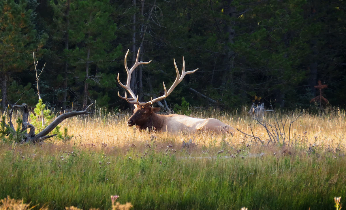
Colorado Muzzleloader Elk Draw Odds 2027 Guide

Related

Colorado Second Rifle Elk Draw Odds 2027 Guide

Colorado's Second Rifle elk season for 2027 is scheduled for: October 23–31, 2027. For limited elk licenses, Colorado's 2027 primary draw still uses the state's existing: Preference-Point System. For elk, applicants with more preference points receive priority for their: First-Choice Hunt Code subject to license quota, residency allocation and other applicable draw rules. Colorado does not use bonus points for the normal 2027 elk primary draw. Actual 2027 draw odds don't exist until the 2027 draw occurs. For planning, compare completed historical data using: Exact Hunt Code + Residency + Preference Points + First-Choice Applicants + License Quota. Don't research only: "GMU 61 Draw Odds." A Colorado GMU can have multiple elk hunt codes based on: Season + Sex + Method + License Type.
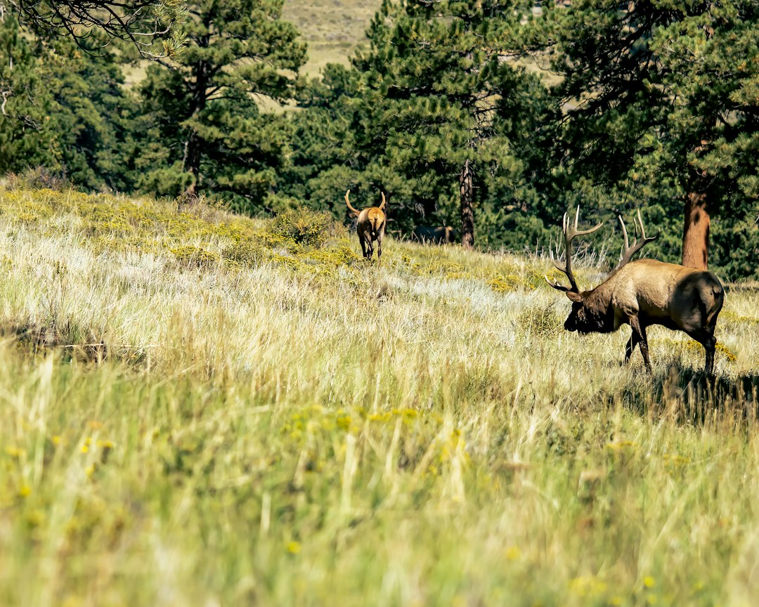
Colorado Second Rifle Elk Draw Odds 2027 Guide

Next

Nevada Elk Draw Odds With 5 Points: 2027 Guide

If you enter Nevada's 2027 elk draw with: 5 Bonus Points your points improve your drawing probability—but they don't create a guaranteed point threshold. Nevada uses a: Squared Bonus-Point Lottery. The formula is: Bonus Points² + 1 = Draw Number Entries With five points: 5² + 1 = 26 So your application receives: 26 Random-Number Entries. The lowest number generated for your application becomes your: Draw Number. Applications are then ranked from the lowest draw number upward. That means: More Points = More Chances to Generate a Low Number but: More Points ≠ Guaranteed Tag. For 2027, analyze: Elk Category + Residency + Weapon + Unit Group + Bonus Points + Hunt Choices + Quota + Historical Applicants.
Nevada Elk Draw Odds With 5 Points: 2027 Guide