Best Public Land Deer Hunting Counties and Locations in Wisconsin for 2027
Wisconsin Public Land Deer Hunting 2027: Quick Answers
What is the best county for public land deer hunting in Wisconsin?
Jackson County is a strong starting point because it contains Black River State Forest, a large public hunting property. However, the best county depends on deer populations, habitat, access, and hunting goals.
Where is the most public land for deer hunting in Wisconsin?
Northern Wisconsin contains extensive public hunting land, including the Chequamegon-Nicolet National Forest.
Can nonresidents hunt Wisconsin public land?
Yes. Eligible nonresidents can hunt public land where deer hunting is permitted with the appropriate Wisconsin license and harvest authorization.
Is Black River State Forest open to deer hunting?
Yes. Wisconsin DNR allows deer hunting in eligible areas during designated seasons, subject to property-specific restrictions.
Where can I find Wisconsin public hunting land maps?
Wisconsin DNR provides public-access mapping resources to help hunters identify eligible hunting properties.
Can you hunt privately owned forest land open to public access?
Yes, on qualifying Managed Forest Law-Open, Forest Crop Law, and other public-access properties, subject to applicable rules.
Best Wisconsin Counties and Public Hunting Locations for 2027
County or RegionPublic Hunting LocationApproximate AcreageJackson CountyBlack River State Forest68,000 acresMarathon, Wood, PortageGeorge W. Mead Wildlife Area33,000+ acresVernon CountyKickapoo Valley Reserve8,569 acresSoutheastern WisconsinKettle Moraine Southern Unit22,000 acresEastern WisconsinKettle Moraine Northern UnitExtensive state forest accessNorthern WisconsinChequamegon-Nicolet National Forest1.5 million+ acres across multiple countiesRusk and Sawyer regionFlambeau River State ForestLarge forest hunting landscapeWaupaca and OutagamieDeer Creek Wildlife AreaApproximately 1,500 acresGreen Lake and Marquette regionGrand River Wildlife AreaVerify property acreageGreen Lake and Marquette regionWhite River Wildlife AreaVerify property acreage
Property acreage does not necessarily equal acreage open to deer hunting. Verify current boundaries, closures, and access restrictions.
1. Jackson County: Black River State Forest
One of Wisconsin's Best Large Public-Land Hunting Options
Black River State Forest contains approximately 68,000 acres in Jackson County near Black River Falls.
The forest includes oak and pine habitat, river corridors, sandy terrain, and varied forest cover.
According to the Wisconsin Department of Natural Resources' official Black River State Forest hunting information, the forest offers whitetail deer hunting during designated seasons, subject to property-specific restrictions.
Why Hunt Black River State Forest?
Potential advantages include:
Large public hunting landscapes
Oak and pine habitat
Forest regeneration
Wetland transitions
Multiple scouting opportunities
Space to research alternative access points
Best Deer Hunting Strategy
Hunters should investigate:
Oak-dominated areas
Young forest regeneration
Timber harvest edges
Pine-to-hardwood transitions
Bedding cover
Natural travel corridors
Deer movement varies with food availability, weather, and hunting pressure.
Important Hunting Restrictions
Wisconsin DNR identifies areas where hunting is prohibited, including designated campgrounds, day-use areas, and posted closures.
Hunters should review the official Black River State Forest property information and maps before entering the field.
Best for: Hunters seeking extensive public acreage and traditional forest whitetail hunting.
Free to join
Download mobile app
- Detailed draw odds
- Point tracking
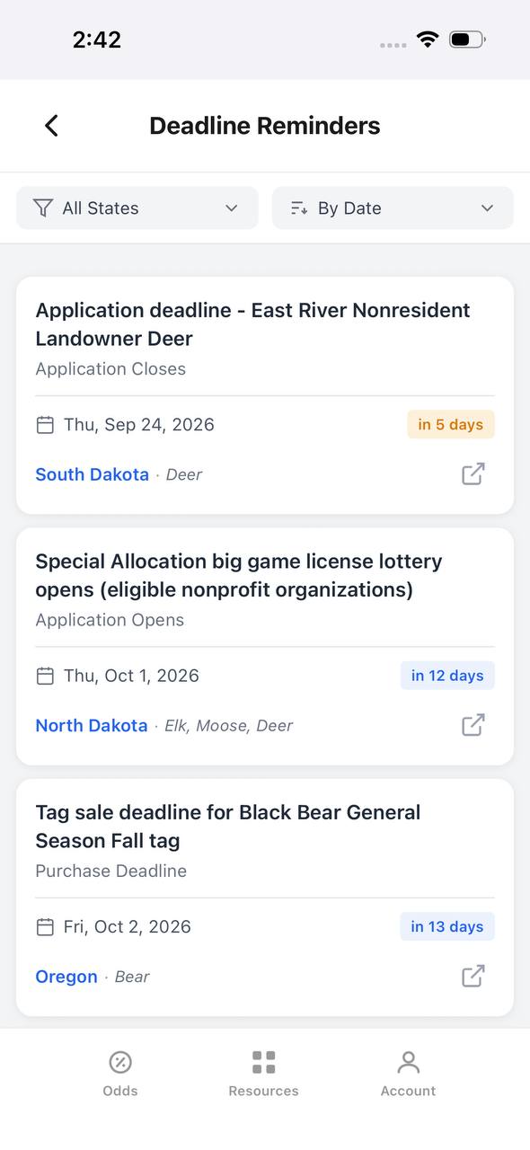
- Deadline reminders
- 18 states covered

Free to join
Download mobile app
- Detailed draw odds
- Point tracking
- Deadline reminders
- 18 states covered
Free to join
Download mobile app
- Detailed draw odds
- Point tracking
- Deadline reminders
- 18 states covered
2. Marathon, Wood, and Portage Counties: George W. Mead Wildlife Area
George W. Mead Wildlife Area encompasses more than 33,000 acres across Marathon, Wood, and Portage counties.
The property contains hardwood forests, aspen, grasslands, marshes, and wetlands.
According to the Wisconsin DNR's George W. Mead Wildlife Area property page, the property provides public hunting opportunities during established seasons, except in designated restricted areas.
Why Hunt Mead Wildlife Area?
The property offers diverse habitat that can support whitetail deer.
Potential scouting locations include:
Hardwood-to-aspen transitions
Forest openings
Wetland boundaries
Higher ground near marshes
Bedding cover
Natural travel corridors
Hunting Strategy
Hunters should focus on locations where suitable cover connects with feeding habitat.
Wetland boundaries and habitat transitions may help identify potential deer travel routes.
Important Restrictions
George W. Mead Wildlife Area contains designated refuge areas.
Before hunting, review the official Wisconsin DNR property maps and access information.
Best for: Hunters seeking large public wildlife areas with mixed forest and wetland habitat.
3. Vernon County: Kickapoo Valley Reserve
The Kickapoo Valley Reserve encompasses approximately 8,569 acres between La Farge and Ontario in Vernon County.
The property features steep ridges, hardwood forests, river valleys, and Driftless Area terrain.
The official Kickapoo Valley Reserve website provides information about the property, recreation opportunities, and access requirements.
Why Hunt the Kickapoo Valley Reserve?
The surrounding terrain offers several features that whitetail hunters commonly research:
Ridge saddles
Wooded benches
Drainage crossings
Hardwood cover
River corridors
Bedding slopes
Hunting the Driftless Area
Steep terrain can influence deer movement.
Hunters may identify potential travel routes where ridges, draws, and feeding areas connect.
However, terrain features should be evaluated through scouting rather than treated as guaranteed deer movement corridors.
Hunting Maps and Restrictions
The reserve has its own hunting and recreation rules.
Hunters should consult the Kickapoo Valley Reserve's official maps and current hunting requirements before selecting a location.
Best for: Hunters interested in southwestern Wisconsin's bluff-country terrain.
4. Southeastern Wisconsin: Kettle Moraine State Forest — Southern Unit
Kettle Moraine State Forest's Southern Unit contains approximately 22,000 acres.
Most of the unit is open to hunting during designated seasons, subject to restrictions.
According to the Wisconsin DNR's Southern Unit hunting information, hunters must observe property boundaries, closures, and designated areas where hunting is prohibited.
Why Hunt Kettle Moraine Southern Unit?
The forest contains glacial terrain, hardwood habitat, rolling hills, and wooded cover.
Hunters may investigate:
Hardwood ridges
Forest openings
Habitat transitions
Bedding cover
Natural terrain funnels
Hunting Pressure and Access
The forest receives recreational use throughout the year.
Hunters should remain aware of hiking trails, recreation areas, and other visitors.
Important Restrictions
Hunting is restricted in campgrounds, picnic areas, wildlife refuges, and other designated locations.
Review the official Southern Unit hunting rules and property maps.
Best for: Hunters seeking public-land opportunities in southeastern Wisconsin.
5. Eastern Wisconsin: Kettle Moraine State Forest — Northern Unit
Kettle Moraine State Forest's Northern Unit provides another public hunting opportunity in eastern Wisconsin.
Wisconsin DNR reports that approximately 95% of the forest is open to public hunting during established seasons.
The official Northern Unit hunting page explains hunting opportunities and property-specific restrictions.
Habitat and Hunting Opportunities
The forest contains:
Hardwood cover
Glacial terrain
Forest openings
Bedding habitat
Travel corridors
Mixed woodland environments
Hunting Strategy
Hunters should research habitat transitions and legal access routes.
Because the forest is used by multiple recreation groups, awareness of other visitors is important.
Important Restrictions
The Mauthe Lake wildlife refuge and certain recreation areas are closed to hunting.
Hunters should verify boundaries using the Wisconsin DNR's Northern Unit hunting information and maps.
Best for: Hunters interested in eastern Wisconsin public-land deer hunting.
6. Northern Wisconsin: Chequamegon-Nicolet National Forest
The Chequamegon-Nicolet National Forest is one of Wisconsin's largest public hunting resources.
Managed by the USDA Forest Service, the forest contains more than 1.5 million acres across northern Wisconsin.
The USDA Forest Service's official Chequamegon-Nicolet hunting information explains hunting opportunities and applicable federal land restrictions.
Chequamegon Division
The Chequamegon portion includes forest lands in:
Ashland County
Bayfield County
Sawyer County
Price County
Taylor County
Vilas County
Nicolet Division
The Nicolet portion includes forest lands in:
Florence County
Forest County
Langlade County
Oconto County
Oneida County
Vilas County
Why Hunt the National Forest?
Potential advantages include:
Extensive public acreage
Remote forest habitat
Diverse vegetation
Multiple access routes
Opportunities for independent scouting
Traditional Northwoods hunting
Northern Wisconsin Hunting Challenges
Hunters may encounter:
Lower deer densities in some areas
Wetlands
Difficult access
Extensive similar-looking habitat
Significant winter-weather effects
Best Hunting Strategy
Focus on habitat diversity.
Potential scouting areas include:
Recent timber harvests
Aspen regeneration
Oak stands
Forest openings
Wetland edges
Secure bedding cover
Hunters should also consult the USDA Forest Service's Chequamegon-Nicolet National Forest resources for maps, closures, and current recreation information.
Best for: Hunters seeking large forest landscapes and remote public-land opportunities.
Free to join
Download mobile app
- Detailed draw odds
- Point tracking
- Deadline reminders
- 18 states covered
Free to join
Download mobile app
- Detailed draw odds
- Point tracking
- Deadline reminders
- 18 states covered
Free to join
Download mobile app
- Detailed draw odds
- Point tracking
- Deadline reminders
- 18 states covered
7. Rusk and Sawyer Region: Flambeau River State Forest
Flambeau River State Forest provides public hunting opportunities in northern Wisconsin.
According to the Wisconsin DNR's Flambeau River State Forest hunting page, whitetail deer hunting is permitted during designated seasons, subject to applicable restrictions.
Why Hunt Flambeau River State Forest?
The forest offers:
Hardwood habitat
River corridors
Forest regeneration
Wetland transitions
Bedding cover
Natural travel routes
Hunting Strategy
Hunters should investigate areas where forest cover connects with food sources and travel corridors.
Important Restrictions
Hunting is prohibited in designated campgrounds, picnic areas, posted closures, and private property without permission.
Review the official Flambeau River State Forest hunting information before hunting.
Best for: Hunters seeking northern Wisconsin forest deer hunting.
8. Waupaca and Outagamie Counties: Deer Creek Wildlife Area
Deer Creek Wildlife Area encompasses approximately 1,500 acres in northeastern Waupaca and northwestern Outagamie counties.
According to the Wisconsin DNR's Deer Creek Wildlife Area property page, the property contains aspen-oak forests, pine plantations, wetlands, sedge meadows, and other wildlife habitat.
Why Hunt Deer Creek?
The property offers a variety of habitat transitions.
Potential scouting areas include:
Aspen-oak boundaries
Pine plantation edges
Forest-to-wetland transitions
Upland bedding cover
Natural travel corridors
Access and Maps
Hunters should review the official Deer Creek Wildlife Area property information for parking, access, and property boundaries.
Best for: Hunters researching smaller public wildlife areas in east-central Wisconsin.
9. Green Lake and Marquette Region: Grand River Wildlife Area
Grand River Wildlife Area is a Wisconsin DNR-managed public wildlife property worth researching for deer hunting.
Hunters can use the Wisconsin DNR's official wildlife area directory to locate property information and available maps.
Why Research Grand River Wildlife Area?
Hunters may find opportunities in a landscape containing wetland and upland habitat.
Potential scouting locations include:
Wetland edges
Upland cover
Forest transitions
Travel corridors
Bedding areas
Important Considerations
Hunters should verify the property's current boundaries, acreage, hunting access, and applicable regulations.
Do not assume that every portion of the property is open to deer hunting.
Best for: Hunters researching central Wisconsin public wildlife areas.
10. Green Lake and Marquette Region: White River Wildlife Area
White River Wildlife Area provides another public property to investigate in central Wisconsin.
The Wisconsin DNR wildlife area directory is an official starting point for finding current property information.
Why Research White River Wildlife Area?
Hunters may find opportunities associated with mixed upland and wetland habitat.
Potential scouting locations include:
Forest edges
Wetland transitions
Bedding cover
Natural travel routes
Hunting Access
Before traveling, verify:
Property boundaries
Legal access points
Hunting restrictions
Deer management unit
Current public-land authorization requirements
Best for: Hunters looking for additional public-land options in central Wisconsin.
Free to join
Download mobile app
- Detailed draw odds
- Point tracking
- Deadline reminders
- 18 states covered
Free to join
Download mobile app
- Detailed draw odds
- Point tracking
- Deadline reminders
- 18 states covered
Free to join
Download mobile app
- Detailed draw odds
- Point tracking
- Deadline reminders
- 18 states covered
Additional Wisconsin Public Hunting Land Opportunities
Wisconsin's public hunting opportunities extend beyond state forests and wildlife areas.
Hunters should also investigate county forests, qualifying privately owned forest land, and public-access programs.
Managed Forest Law-Open Properties
Wisconsin's Managed Forest Law program allows qualifying privately owned forest land to be enrolled for public recreation.
Certain properties designated MFL-Open allow public hunting under applicable rules.
The Wisconsin DNR's Managed Forest Law hunting access guidance explains public access requirements and restrictions.
Forest Crop Law Properties
Forest Crop Law properties may also provide public hunting access.
Hunters should verify legal access routes and applicable rules.
Voluntary Public Access Program
Wisconsin's Voluntary Public Access program provides opportunities to use qualifying private lands for designated public recreation.
The Wisconsin DNR's Voluntary Public Access information explains how the program works.
These properties can be valuable in areas where conventional public hunting land is limited.
How to Find Wisconsin Public Hunting Land Maps
Wisconsin DNR provides mapping resources to help hunters identify public hunting properties.
Start with the Wisconsin DNR public lands information and the state wildlife areas directory.
What to Look for on Public Hunting Maps
Property boundaries
State-owned land
Federal land
County forests
MFL-Open properties
Forest Crop Law properties
Voluntary Public Access properties
Parking areas
Legal access routes
Deer management unit boundaries
Important Map Considerations
Digital maps can contain outdated information.
Hunters should verify current boundaries, posted closures, and property-specific restrictions before hunting.
Best Wisconsin Public Land Deer Hunting by Hunting Style
Hunting GoalLocations Worth ResearchingLarge forest huntingBlack River State ForestRemote Northwoods huntingChequamegon-Nicolet National ForestMixed wetland and hardwood habitatGeorge W. Mead Wildlife AreaBluff-country terrainKickapoo Valley ReserveSoutheastern Wisconsin accessKettle Moraine Southern UnitEastern Wisconsin forest huntingKettle Moraine Northern UnitSmaller wildlife areasDeer Creek Wildlife AreaNorthern river and forest habitatFlambeau River State ForestCentral Wisconsin public-land researchGrand River and White River wildlife areas
These recommendations reflect access and habitat characteristics rather than verified 2027 deer harvest rankings.
How to Scout Wisconsin Public Land for Whitetail Deer
Public-land deer hunting requires understanding deer habitat and hunting pressure.
Step 1: Identify Food Sources
Depending on the region, deer may use:
Agricultural crops
Acorns
Natural browse
Forest regeneration
Openings and edge habitat
Step 2: Locate Bedding Cover
Potential bedding habitat includes:
Thick young forest
Brushy cover
Wetland edges
Secluded ridges
Dense conifer stands
Step 3: Study Travel Corridors
Look for connections between bedding cover and feeding habitat.
Terrain funnels, drainage crossings, and vegetation transitions can provide scouting opportunities.
Step 4: Evaluate Hunting Pressure
Consider parking areas, road access, popular trails, and nearby hunting activity.
Step 5: Prepare Backup Locations
Public hunting properties are shared resources.
Having multiple locations can help hunters adapt to changing conditions.
Step 6: Verify Legal Access
Use official property maps and confirm current restrictions.
Wisconsin Public Land Deer Hunting Regulations for 2027
Hunters must comply with Wisconsin's current deer hunting regulations.
Important requirements include:
Valid deer hunting license
Appropriate buck or antlerless harvest authorization
Deer management unit restrictions
Public/private land authorization designation
Legal hunting equipment
Season dates
Blaze orange or fluorescent pink requirements
Legal shooting hours
Baiting and feeding restrictions
Property-specific closures
Mandatory deer registration
CWD and carcass transportation requirements
The Wisconsin DNR's official deer hunting page provides current regulations and hunting information.
Hunters should verify the finalized 2027 regulations before traveling.
Free to join
Download mobile app
- Detailed draw odds
- Point tracking
- Deadline reminders
- 18 states covered
Free to join
Download mobile app
- Detailed draw odds
- Point tracking
- Deadline reminders
- 18 states covered
Free to join
Download mobile app
- Detailed draw odds
- Point tracking
- Deadline reminders
- 18 states covered
Best Time to Hunt Wisconsin Public Land in 2027
September: Early Archery Season
Hunters may focus on feeding patterns and bedding areas.
October: Pre-Rut Hunting
As fall progresses, bucks may increase scraping, rubbing, and travel activity.
November: Rut and Gun Season
November provides opportunities associated with whitetail breeding behavior and Wisconsin's traditional firearm season.
Under the traditional nine-day framework, Wisconsin's 2027 gun deer season is projected for November 20–28, pending official confirmation.
December: Late-Season Hunting
Hunters may focus on available food sources, bedding cover, and changing winter conditions.
Common Wisconsin Public Land Deer Hunting Mistakes
Mistake 1: Choosing a County Based Only on Trophy Reputation
A county with famous trophy bucks may offer limited public access.
Mistake 2: Assuming Every Public Property Is Open to Hunting
Some properties contain restricted areas or special regulations.
Mistake 3: Ignoring Deer Management Unit Boundaries
Antlerless harvest authorizations may be unit-specific.
Mistake 4: Overlooking Public/Private Land Tag Restrictions
The correct authorization matters.
Mistake 5: Hunting Only Near Popular Access Points
Heavy hunting pressure can influence deer behavior.
Mistake 6: Failing to Research CWD Regulations
Carcass transportation and testing guidance can affect hunting plans.
Mistake 7: Not Preparing Backup Locations
Public hunting properties are shared resources.
Mistake 8: Assuming Large Acreage Means High Deer Density
Large forests may offer extensive access but relatively low deer densities.
Wisconsin Public Land Deer Hunting 2027: Frequently Asked Questions
What is the best public land for deer hunting in Wisconsin?
Black River State Forest, George W. Mead Wildlife Area, Kettle Moraine State Forest, and Chequamegon-Nicolet National Forest are strong research candidates because of their public hunting opportunities.
Which Wisconsin county has the most public hunting land?
The answer depends on whether federal, state, county, and qualifying private-access lands are included. Hunters should compare current public acreage using Wisconsin DNR mapping resources.
Can nonresidents hunt Wisconsin state forests?
Yes, where hunting is permitted and with the appropriate license and harvest authorization.
Is Black River State Forest good for deer hunting?
The forest provides extensive public acreage and suitable deer habitat, but success depends on local deer distribution, scouting, and hunting pressure.
Can you hunt deer in Chequamegon-Nicolet National Forest?
Deer hunting is generally permitted on eligible national forest lands during Wisconsin's open seasons, subject to applicable federal and state regulations.
Is Kettle Moraine State Forest open to deer hunting?
Yes. Hunting is permitted in eligible areas during established seasons, subject to restrictions.
Can you hunt deer in the Kickapoo Valley Reserve?
Hunting opportunities exist, but hunters must verify the reserve's current hunting regulations and access requirements.
Can you hunt Wisconsin county forests?
Many county forests allow deer hunting, but property-specific regulations must be verified.
Are MFL-Open lands considered public land for antlerless authorizations?
Yes. Qualifying MFL-Open properties are treated as public land for applicable Wisconsin antlerless authorization purposes.
Can you camp on Wisconsin public hunting land?
Camping regulations vary by property. Hunters should verify the rules for their selected location.
Does Wisconsin have a public-land deer tag lottery?
Standard Wisconsin deer hunting licenses generally do not require a statewide limited-entry drawing. Antlerless authorizations may have availability restrictions.
Plan Your Wisconsin Public Land Deer Hunt With TAGZ
Wisconsin offers extensive public-land whitetail hunting opportunities across a variety of landscapes.
Hunters interested in large forests may prefer Black River State Forest or the Chequamegon-Nicolet National Forest.
Those seeking mixed wetlands and hardwood habitat may research George W. Mead Wildlife Area.
Hunters interested in southwestern Wisconsin's Driftless Area can investigate the Kickapoo Valley Reserve.
Southeastern Wisconsin hunters may find opportunities in Kettle Moraine State Forest.
TAGZ was built by hunters, guides, and outfitters to simplify hunting research and planning.
TAGZ helps hunters explore supported hunting opportunities, compare available hunting information, and organize future hunting plans.
Whether you're researching Wisconsin public-land whitetails or preparing for Western elk and mule deer applications, TAGZ is designed to help hunters make informed decisions.
Explore TAGZ:
Find legal access. Research the habitat. Plan your next hunt with TAGZ.
TAGZ Editorial Standards
TAGZ is a hunting draw-odds and hunt-planning platform built by hunters, guides, and outfitters with firsthand experience in the hunting industry.
Our content is designed to help hunters navigate hunting regulations, application systems, draw odds, and hunting opportunities across North America.
TAGZ prioritizes information from official state wildlife agencies, published hunting regulations, and available draw data. Our editorial approach emphasizes accuracy, transparency, and practical information that helps hunters make informed decisions.
Hunting regulations, application deadlines, permit availability, and draw odds can change. We encourage hunters to verify all requirements with the appropriate wildlife agency before applying or hunting.
Learn more: About TAGZ
Editorial note: Last updated October 6, 2026. Public hunting locations and acreage figures are based on published agency property information. These are research recommendations, not verified rankings of 2027 hunting success. Confirm current access, property boundaries, closures, and regulations before hunting.
Was this article helpful?
Previous
Alaska Guided Caribou Hunts 2027: Costs & Tags
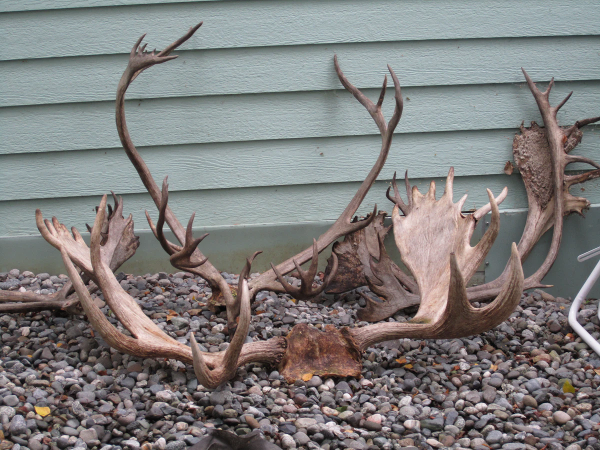
Alaska caribou hunting offers everything from fully guided fly-in expeditions to independent wilderness hunts. The best choice depends on the hunter's experience, budget, preferred hunting conditions, and available legal opportunities. The most important considerations for 2027 are: Cost: Guided packages may require a five-figure budget, with transportation, tags, lodging, and meat shipping potentially adding thousands more. Nonresident eligibility: U.S. nonresidents generally do not need a guide for caribou, but nonresident aliens must use an Alaska-licensed guide for big-game hunting. Permit requirements: Depending on the area, caribou hunts may involve general-season harvest tickets, registration permits, or drawing permits. Draw odds: Alaska does not use conventional preference or bonus points for regular drawing hunts. Hunting areas: Herd population trends, nonresident restrictions, access, and current regulations matter more than historical reputation. Outfitter selection: Verify professional licensing, authorized operating areas, recent hunting experience, and transportation arrangements before paying a deposit. 2027 regulations: Specific dates, quotas, and opportunities must be checked against the applicable Alaska Department of Fish and Game publications. Key takeaways: Guided Alaska caribou hunts can cost approximately $8,000–$18,000 or more per hunter, depending on the outfitter, location, transportation, and services included. Alaska generally does not require nonresident hunters to hire a guide for caribou, although particular permit opportunities may distinguish between guided and unguided applicants. Some caribou hunts use registration or general-season opportunities, while others require drawing permits. Alaska does not use a preference-point or bonus-point system for its regular drawing hunts. Caribou populations, hunt availability, and harvest limits can change substantially between seasons. Hunters should verify 2027 regulations and outfitter credentials before booking. This guide explains how to choose a guided caribou hunt, understand Alaska's permit system, compare outfitter packages, and build a realistic hunting budget.
Related
Alaska Nonresident Caribou Draw Odds 2027: Tags & Hunts
Quick Answer: Can Nonresidents Draw Alaska Caribou Tags in 2027? Yes. Nonresidents can apply for eligible Alaska caribou drawing permits, and Alaska does not use bonus or preference points in its drawing system. Every eligible drawing entry is selected randomly. For the 2026–2027 regulatory year, Alaska listed several caribou drawing opportunities available to nonresidents, including: DC001 — Kenai Mountains, Unit 7 DC590 — Units 14A and 14B DC608 — Killey River, Unit 15B DC618 — Fox River, Unit 15C DC826 — Central Alaska Range, Unit 20A, unguided nonresidents DC828 — Central Alaska Range, Unit 20A, guided nonresidents DC923 — Unit 23, nonresidents only The state also provides general-season and registration opportunities under separate regulations. The best 2027 strategy is to identify the exact hunt code, verify nonresident eligibility, compare historical drawing results, and determine whether a draw permit is necessary for the hunt you want.
Next
Arizona Mule Deer Draw Odds 2027: Tags, Bonus Points & Best Units
Arizona is one of the most sought-after mule deer hunting destinations in the United States. From the legendary Arizona Strip to the Kaibab Plateau and southern Arizona's desert country, hunters can pursue mule deer across dramatically different landscapes. However, drawing an Arizona mule deer tag requires understanding the state's bonus-point system, permit allocations, and hunt-specific application rules. Key takeaways for 2027: Arizona uses a bonus-point system, not a traditional preference-point system, for its big-game drawings. Arizona generally allocates up to 20% of available permits in the bonus-point pass, with remaining permits considered in the subsequent drawing process. Nonresident hunters are subject to permit allocation limits, generally up to 10% of the permits available for a particular hunt. Premium mule deer hunts in the Arizona Strip and Kaibab region can be highly competitive. Some Arizona deer opportunities are available through over-the-counter nonpermit-tag systems, subject to applicable restrictions. The best hunt depends on your bonus-point balance, residency, weapon preference, hunting goals, and willingness to wait. Official 2027 permit numbers, application deadlines, and draw results must be verified with the Arizona Game and Fish Department. TAGZ helps hunters research draw opportunities, compare hunting options, and develop long-term application strategies.