Best Elk Hunting in Wyoming: Top Units and Strategies for 2027
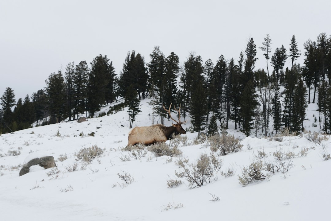
Wyoming ranks among the elite elk hunting destinations in the West, combining high elk populations, vast public land, and a mix of general and limited-quota opportunities. For 2027, hunters can target wilderness units producing 350-class bulls, general areas with solid success rates, and limited-entry zones where draw odds remain manageable compared to neighboring states. The key is matching your points, budget, and hunting style to the right unit and season.
Why Wyoming Stands Out for Elk Hunters
Wyoming's elk hunting structure splits into general licenses and limited-quota (Type 1) tags. General licenses allow hunting across broad regions without a draw, though nonresident general tags are limited and sell out quickly. Limited-quota units require applying through the draw but offer controlled pressure, better bull-to-cow ratios, and higher trophy potential. Wilderness areas in Regions G, H, and K hold some of the state's largest bulls, but nonresidents must hunt with an outfitter or licensed resident guide in designated wilderness. This outfitter requirement thins nonresident pressure in prime backcountry zones, creating exceptional opportunity for those willing to book a guide.
The state's elk herd exceeds 110,000 animals, distributed across mountain ranges from the Absaroka and Wind River ranges to the Wyoming and Salt River ranges. Statewide hunter success hovers around 40 percent for rifle hunters, with top units pushing 60 to 70 percent. Archery and muzzleloader hunters face lower success but encounter bugling bulls and less competition.
Top Limited-Quota Units for Trophy Bulls
Unit 100 in the Wyoming Range consistently produces mature bulls and ranks as one of the state's premier limited-entry elk hunts. This unit features steep timbered slopes, alpine basins, and significant wilderness acreage. Bulls here commonly score 320 to 350 inches, with occasional 360-plus monarchs. Nonresident rifle hunters typically need 8 to 12 preference points to draw, depending on the season. Archery tags require fewer points, often 4 to 6, but success rates drop below 30 percent. Resident odds remain more favorable, with mid-tier point holders drawing regularly.
Unit 90 in the Salt River Range offers similar quality with slightly better draw odds. This unit's mix of open parks and lodgepole timber produces heavy-bodied bulls in the 320 to 340 range. Nonresident rifle tags often take 6 to 10 points. The September archery season coincides with peak bugling, and hunters who scout pre-season and locate high-elevation wallows see strong results.
Region G wilderness units, particularly Areas 85, 87, and 89, deliver world-class elk hunting for hunters willing to book an outfitter. These units sit inside the Bridger-Teton National Forest and abut Yellowstone's southern boundary. Bulls here have minimal pressure outside of hunting season and mature into the 340 to 370 class. Nonresident rifle tags require 10 to 15 points in the best units, but the investment pays off with high success rates and genuine trophy potential. Archery hunters can often draw with 5 to 8 points and hunt during the rut, though rugged terrain and grizzly bear presence demand serious backcountry skills.
Best General License Areas
Wyoming's general elk license covers large portions of the state, with Region G, H, and K offering the most consistent action. Region G general areas include accessible zones outside the wilderness boundary where nonresidents can hunt without a guide. Units like 86 and 88 see moderate pressure but hold solid elk numbers. Success rates for general license holders in Region G typically run 35 to 45 percent for rifle hunters. The key is hunting weekdays, pushing away from trailheads, and targeting timber pockets where elk retreat during daylight.
Region H in the Absaroka Range provides another strong general license option. This region's mix of rugged mountains and timbered drainages holds healthy elk herds, though bulls skew younger due to higher hunter density. Resident hunters dominate this area, and nonresidents who draw general tags often find better opportunity by hiking past the first mile of trail. Calling works well during September archery season, especially in higher basins where bulls haven't been pressured.
Region K in the Bighorn Mountains offers general hunting with lower elk density but less competition. Bulls here rarely reach 320 inches, but success rates for patient hunters remain respectable. This region works well for hunters seeking a DIY experience without the wilderness outfitter requirement. Focus on north-facing slopes and quaking aspen groves during early rifle season, when bulls are still moving between feeding and bedding areas.
Draw Strategy and Point Management
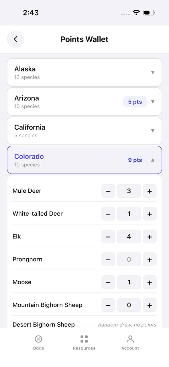
Wyoming's preference point system guarantees that hunters with the most points draw first within each applicant pool. Nonresidents can apply for one elk area in the initial draw and may select up to three choices in order of preference. The special draw, which requires a higher license fee, cuts draw odds roughly in half compared to the regular draw for the same tags. If your point total falls short of the top-tier units, applying in the special draw increases your chance of drawing mid-tier units like 90 or 94.
Frontier hunts (Type 6 and Type 7 licenses) offer another path to elk opportunity without burning points. These cow and either-sex hunts occur on select ranches and public parcels, often late in the season. While they don't match the quality of limited-entry bull hunts, they provide meat hunters and point-building applicants a chance to hunt elk annually. Applying for a frontier hunt as a second or third choice preserves your first-choice points even if you draw the frontier tag.
Residents should apply for top units early in their hunting careers and build points steadily. Nonresidents must decide whether to burn points on a premier unit or settle for a mid-tier tag that draws with fewer points. The key threshold sits around 10 points for nonresidents, where units like 100 and select Region G areas become realistic. Below that, focus on units drawing with 4 to 7 points or hunt general areas while building points for a future premium hunt.
Free to join
Download mobile app
- Detailed draw odds
- Point tracking
- Deadline reminders
- 19 states covered

Free to join
Download mobile app
- Detailed draw odds
- Point tracking
- Deadline reminders
- 19 states covered
Free to join
Download mobile app
- Detailed draw odds
- Point tracking
- Deadline reminders
- 19 states covered
Archery vs. Rifle Season Strategy
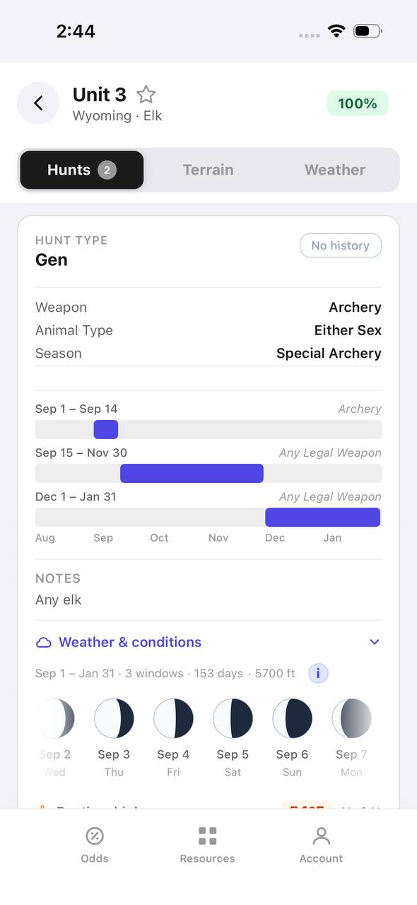
Archery season runs September 1 through 30 statewide, overlapping with peak rut in most units. Bulls are vocal, responsive to calls, and predictable near water sources. However, elk occupy higher elevations during September, requiring backpack hunts or stock support in many units. Success rates for archery hunters average 20 to 30 percent, rising to 40 percent in top units for hunters who scout and commit to multiple days in the backcountry. The archery season offers a wilderness exception, allowing nonresidents to hunt without a guide if they remain outside designated wilderness boundaries.
Rifle season splits into multiple hunts, with the most popular running mid-September through October. By rifle opener, bulls have largely stopped bugling but remain in transitional patterns between summer and winter range. Hunting pressure increases significantly once rifles enter the field, and elk shift to nocturnal movement in heavily hunted areas. Success rates jump to 40 to 60 percent for rifle hunters, depending on unit and weather. Snow pushes elk to lower elevations and concentrates herds, improving odds for hunters willing to adjust plans as conditions change.
Muzzleloader hunters face a middle ground. Season dates vary by unit but often occur during late September or early October. Elk are transitioning out of rut behavior, making calling less effective, but rifle pressure hasn't yet scattered herds. Muzzleloader success rates typically run 30 to 40 percent. This season works well for hunters who want less competition than rifle season but higher success odds than archery.
Public Land Access and Logistics
Wyoming holds over 48 million acres of public land, the majority managed by the U.S. Forest Service and Bureau of Land Management. National forests in elk country include Bridger-Teton, Shoshone, Medicine Bow, and Bighorn. Most top elk units feature 70 to 90 percent public land, with wilderness designations adding another layer of access consideration for nonresidents. OnX or similar mapping tools are essential for identifying legal access routes and avoiding inadvertent trespass on private inholdings.
Trailheads in popular units fill quickly during rifle season, especially opening weekend. Hunters willing to hike 3 to 5 miles from roads see dramatically lower encounter rates with other hunters. Stock users gain access to deeper basins, though outfitters hold priority for many trailheads in wilderness zones. For general license hunts, scout multiple access points and have backup drainages identified before season opens.
Nonresidents planning wilderness hunts must budget for outfitter costs, which typically range from 4,000 to 8,000 dollars for a 7- to 10-day guided hunt. Drop-camp services run lower, around 2,000 to 4,000 dollars, but still require the licensed guide component to satisfy wilderness regulations. Resident hunters may guide nonresident friends or family if they hold a Wyoming guide license, but this requires passing the state exam and maintaining required insurance.
Hunting the Rut in September
September elk hunting revolves around locating and calling bugling bulls. By the first week of September, herd bulls are actively gathering cows and defending harems. Satellite bulls cruise the edges, waiting for opportunities to challenge. Mornings produce the most vocal activity, typically from first light until mid-morning as bulls move cows to bedding areas. Evenings see renewed bugling as herds transition to feeding zones, though bulls often remain less vocal than mornings.
Set up calling sequences near high-elevation wallows, saddles connecting feeding and bedding areas, and dark timber patches where cows bed during midday. Use locator bugles to pinpoint bulls, then close distance before initiating aggressive calling sequences. When a bull responds, alternate cow calls and challenge bugles to simulate a competing bull stealing cows. If a bull commits, he'll often charge into bow range within minutes.
Cows drive herd dynamics during the rut. Bulls follow cows more than cows follow bulls. Identify where cows prefer to feed and bed, and bulls will be nearby. Glass open parks at dawn and dusk for feeding herds, noting which drainages they use to access bedding timber. Return the next morning and intercept bulls as they push cows uphill.
Free to join
Download mobile app
- Detailed draw odds
- Point tracking
- Deadline reminders
- 19 states covered
Free to join
Download mobile app
- Detailed draw odds
- Point tracking
- Deadline reminders
- 19 states covered
Free to join
Download mobile app
- Detailed draw odds
- Point tracking
- Deadline reminders
- 19 states covered
Weather and Timing for Rifle Hunters
Rifle season success hinges on weather patterns and hunting pressure timing. Opening weekend sees maximum hunter presence, pushing elk into dark timber and private land sanctuaries. If possible, hunt weekdays or wait until the second week when casual hunters have left. Elk relax slightly and resume more predictable movement patterns.
Snow transforms elk behavior. The first significant snowfall, typically late September or early October, pushes elk from high basins toward mid-elevation timber and south-facing slopes. Overnight accumulations of 6 to 12 inches trigger major movements, with herds relocating miles within 24 hours. Hunters who monitor weather and reposition quickly gain enormous advantage. After snow, focus on fresh tracks leading from high country and set up along migration corridors.
Wind matters more than most hunters realize. Elk rely on thermals and prevailing winds to detect danger. Morning thermals rise upslope, pulling scent toward ridgetops. Plan stalks and stand locations accordingly, hunting uphill in mornings and downhill in evenings when thermals reverse. Canyon drainages create swirling winds that make scent control nearly impossible. On windy days, focus on timbered benches and leeward slopes where elk seek shelter.
Unit 100 Deep Dive
Unit 100 deserves special attention as Wyoming's most coveted general-draw elk unit. Located in the Wyoming Range south of Jackson, this unit spans the Bridger-Teton National Forest and includes limited wilderness acreage. Terrain varies from sage and quaking aspen foothills at 7,000 feet to alpine ridges above 11,000 feet. Elk summer in high basins and migrate to mid-elevation winter range as snow accumulates.
The Type 1 rifle tag for Unit 100 typically requires 10 to 12 nonresident preference points in the regular draw, or 6 to 8 in the special draw. Archery tags draw with fewer points, around 4 to 6, but terrain and elk distribution during September make this a challenging bow hunt. Success rates for rifle hunters exceed 60 percent in most years, with average bull scores in the 310 to 330 range and mature bulls pushing 350 to 370.
Focus hunting effort on the central and southern portions of the unit, where roadless blocks and limited motorized access hold less-pressured elk. The northern sections near Hoback Canyon see heavier traffic due to easier highway access. Scout pre-season to locate wallows, rubs, and feeding areas. By rifle season, elk concentrate in timbered north-facing slopes and quaking aspen groves at mid-elevations. Glass open ridges at dawn and dusk, then plan stalks into timber edges where bulls bed.
Gear and Preparation
Wyoming elk hunting demands fitness and appropriate gear. High-elevation hunts start above 8,000 feet and climb to 10,000 or higher. Train with a weighted pack, logging vertical feet on stairs or hills. Expect to hike 5 to 10 miles daily with 40 to 60 pounds on your back if hunting solo or without stock support.
Layering systems must handle temperature swings from freezing mornings to 60-degree afternoons. Pack merino base layers, insulating mid-layers, and a windproof outer shell. Rain gear is non-negotiable, as afternoon thunderstorms are common through September. For rifle hunters, October weather turns colder, requiring heavier insulation and anticipating snow.
Optics matter more than rifle caliber in Wyoming's open terrain. A quality spotting scope (65mm to 85mm) paired with 10x or 12x binoculars allows glassing distant basins and ridges. Identify elk from miles away, plan approach routes, and avoid bumping animals with aimless hiking. For archery hunters, a rangefinder capable of reading distances to 100-plus yards is essential in open parks where shot opportunities materialize at 60 to 80 yards.
Meat care becomes critical once an elk is down. Wyoming's warm September days require immediate attention to cooling meat. Bone out quarters and hang meat in shade with game bags providing airflow. If temperatures exceed 50 degrees during the day, pack meat out the same day or move quarters to a creek for cooling overnight. Rifle hunters in October benefit from cooler weather but must still prioritize rapid cooling to preserve meat quality.
Free to join
Download mobile app
- Detailed draw odds
- Point tracking
- Deadline reminders
- 19 states covered
Free to join
Download mobile app
- Detailed draw odds
- Point tracking
- Deadline reminders
- 19 states covered
Free to join
Download mobile app
- Detailed draw odds
- Point tracking
- Deadline reminders
- 19 states covered
Resident vs. Nonresident Considerations
Residents enjoy significant advantages in Wyoming's elk draws. Resident Type 1 tags in top units like 100 or Region G wilderness areas draw with roughly half the points required for nonresidents. Residents also receive 75 percent of limited-quota tags in the initial draw, with the remaining 25 percent allocated to nonresidents. General elk licenses for residents cost a fraction of nonresident fees and don't require a draw.
Nonresidents face steeper costs and planning challenges. The nonresident elk license fee is 692 dollars, with preference points costing 50 dollars. Special draw fees add another 294 dollars, bringing total application costs to nearly 1,000 dollars before drawing a tag. For wilderness hunts, add outfitter expenses. Despite these costs, Wyoming offers better draw odds for quality tags than Colorado or Utah for comparable units, making it worth the investment for serious elk hunters.
Nonresident general licenses are limited and distributed through a separate draw. Demand exceeds supply, so applying early in the license year maximizes your chance of securing a general tag. Alternatively, focus point-building on limited-quota units and plan a premium hunt once points accumulate.
Migration Corridors and Late-Season Opportunity
Late-season elk hunts, typically November and December, target elk migrating to winter range. Doe/fawn and either-sex tags become available through leftover draws or over-the-counter sales after the initial draw. These hunts occur at lower elevations, often on a mix of public land and accessible private parcels enrolled in Walk-In Hunting Areas.
Elk migrate along traditional corridors, following the same ridges and drainages annually. The Red Desert to Hoback migration, one of the longest elk migrations documented, sees herds traveling over 100 miles from summer to winter range. Hunters targeting migration hunts should identify bottleneck areas where terrain funnels elk movement. Saddles, low passes, and timbered ridges connecting high and low country concentrate elk during migration pulses.
Snow depth drives migration timing. Expect major movements after the first heavy storm drops 12-plus inches in high country. Elk move rapidly, covering miles overnight. Hunters who position themselves along known routes during active migration encounter large herds and high opportunity. However, once elk reach winter range, they often concentrate on private land, limiting public-land hunting options.
Mistakes to Avoid
Many first-time Wyoming elk hunters underestimate the state's size and terrain. Units span hundreds of square miles, and elk are mobile. Avoid the trap of hunting a single drainage all week. If elk aren't present, move. Scout multiple areas pre-season and maintain flexibility during the hunt.
Over-reliance on roads and ATVs limits success. The best elk occupy roadless areas, and motorized restrictions protect backcountry zones. Hunters who commit to hiking see elk other hunters never reach. Pack light enough to stay mobile but heavy enough to pack meat if successful.
Ignoring private land boundaries causes problems. Wyoming's checkerboard land ownership in some areas creates complex access challenges. Corner crossing remains legally uncertain, so avoid it unless you've consulted with an attorney. Trespass violations carry stiff fines and jeopardize future hunting privileges. Use GPS mapping tools constantly to track your location relative to boundaries.
Waiting too long to apply costs points and opportunity. Preference point creep pushes top units higher each year. If you're waiting for the perfect year, you may wait forever. Apply consistently, monitor draw odds, and pull the trigger when your points make a quality tag realistic.
FAQ — Wyoming Elk Hunting
What is the best elk unit in Wyoming for nonresidents?
Unit 100 offers the best combination of trophy quality, success rates, and manageable draw odds, typically requiring 10 to 12 preference points for rifle tags. Region G wilderness areas produce larger bulls but demand more points and an outfitter.
Can nonresidents hunt elk without an outfitter in Wyoming?
Yes, nonresidents can hunt general and limited-quota units on their own, but they must hire an outfitter or licensed guide to hunt inside designated wilderness areas. Wilderness restrictions apply only within specific boundaries, leaving vast public land accessible for DIY hunters.
How many preference points do I need for a good Wyoming elk tag?
Mid-tier units like 90 draw with 6 to 10 nonresident points, while premium units like 100 require 10 to 12. Archery tags need fewer points across the board, often 4 to 6 for top units. Resident hunters draw comparable tags with half the points.
Are Wyoming general elk licenses hard to draw for nonresidents?
Yes, nonresident general elk licenses are limited and demand exceeds supply. Apply early in the license year, as tags are distributed in the order applications are received until the quota is met. Leftover general licenses rarely exist.
What is the success rate for elk hunting in Wyoming?
Statewide rifle elk success averages 40 percent, with top limited-entry units exceeding 60 percent. Archery hunters see 20 to 30 percent success, while muzzleloader hunters average 30 to 40 percent. General license areas trend lower, around 30 to 35 percent.
When is the best time to hunt elk in Wyoming?
September archery season during the rut offers vocal bulls and peak calling opportunity. Early October rifle hunts benefit from transitional elk movement and less pressure than opening weekend. Late October hunts capitalize on snow pushing elk to lower elevations.
Was this article helpful?
Previous
Bison Hunt Logistics: Meat Recovery, Cooling & Transport in 2027
Successfully harvesting a bison is only the beginning — proper field care, cooling, and transport are critical to preserving 400–600 pounds of meat in remote terrain.

Related
Public Land Elk Hunting in Oregon: 2027 Units, Tags & Draw Strategy
Oregon offers 450,000+ acres of public elk habitat spanning general and controlled hunt units. Success hinges on weapon choice, unit selection, and understanding Oregon's preference point system for premium tags.
Next
DIY Elk Hunting in Utah: 2027 Guide to Public Land, Units, and Draw Strategy
Utah offers exceptional DIY elk hunting with over-the-counter spike tags, limited-entry bull hunts, and millions of acres of public land. This guide covers draw strategy, top units, weapon seasons, and how to plan your 2027 hunt.